

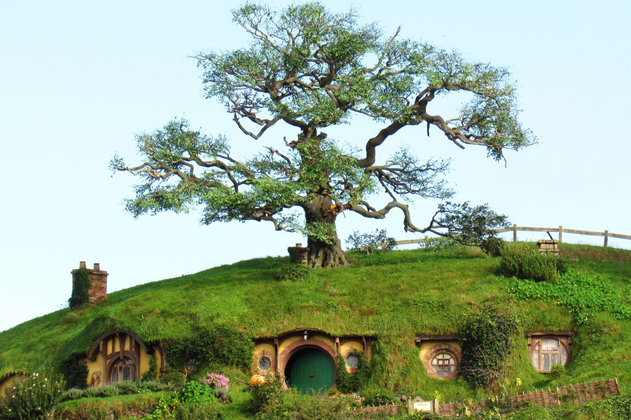
The amazing South Island of New Zealand
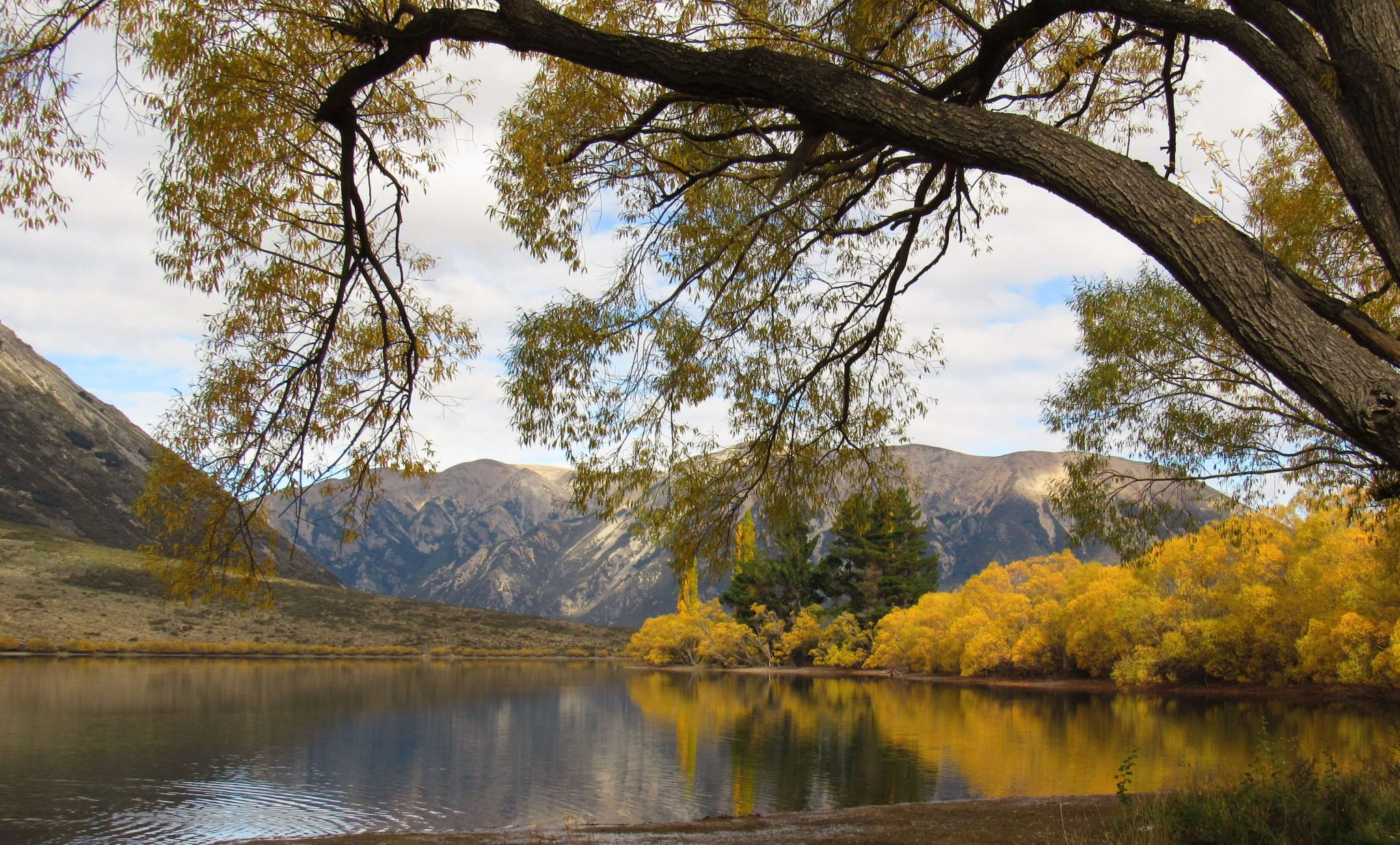
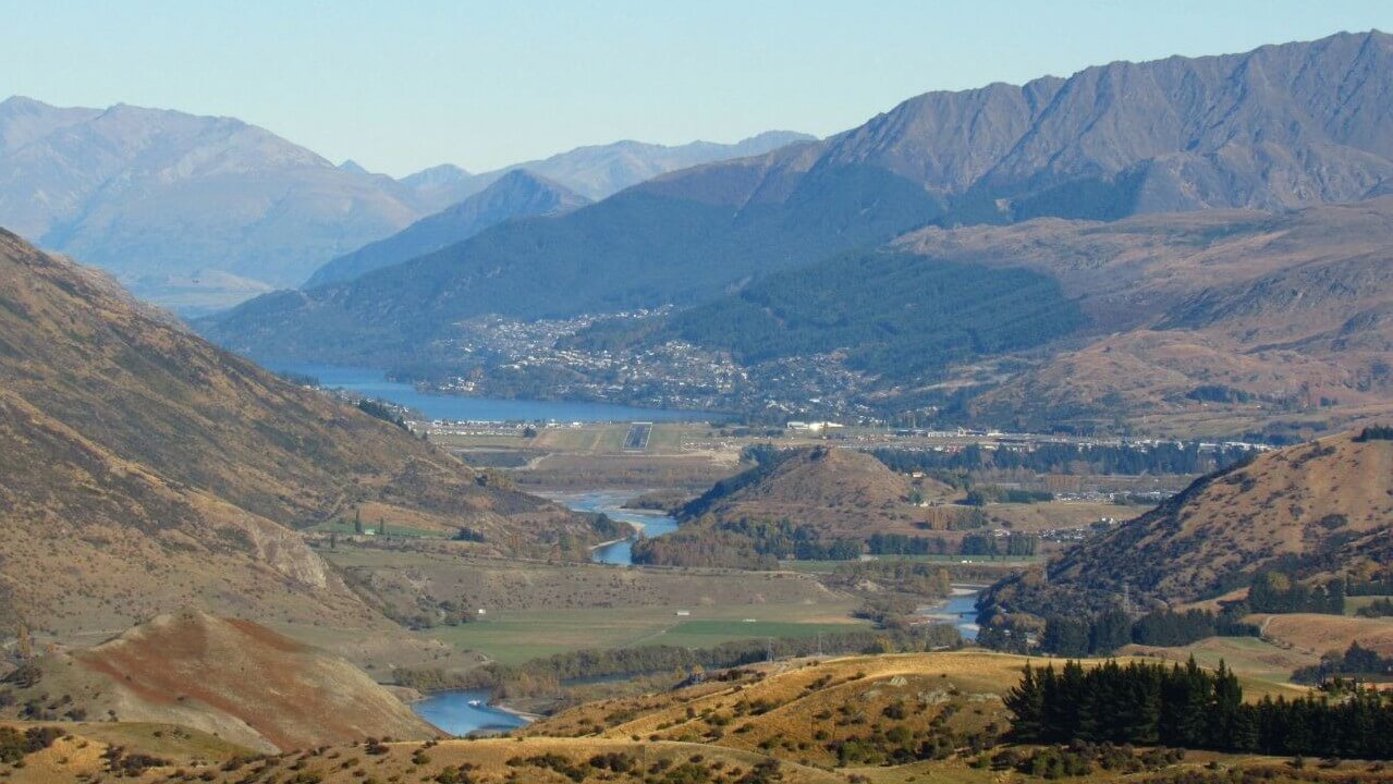
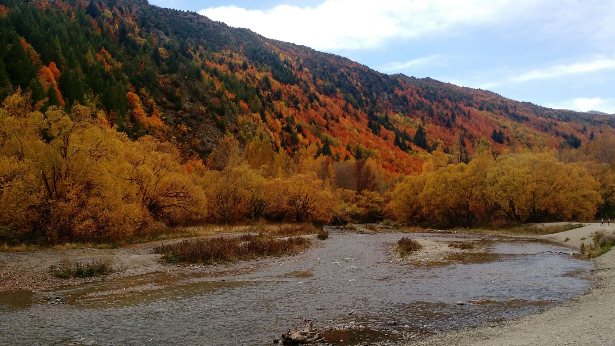
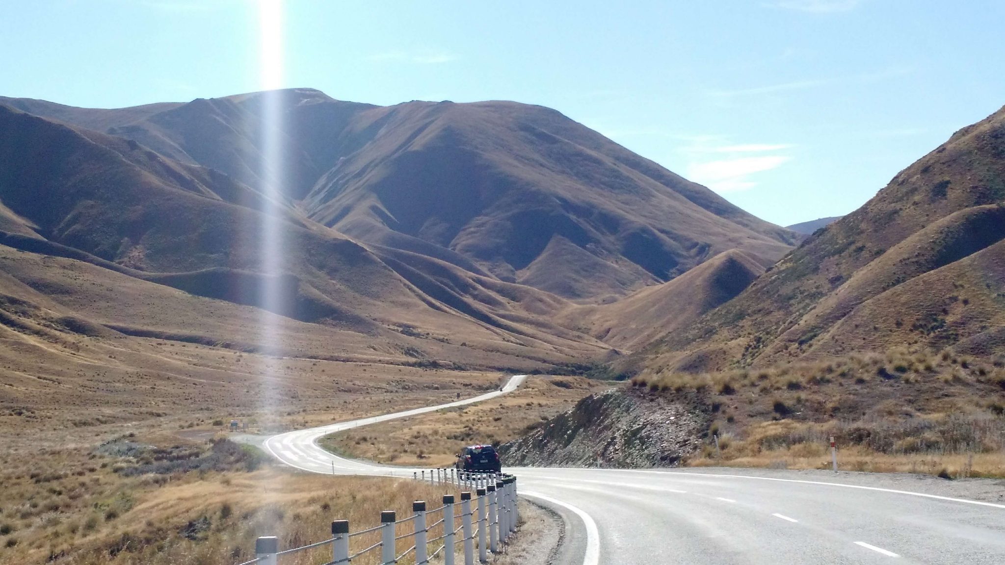
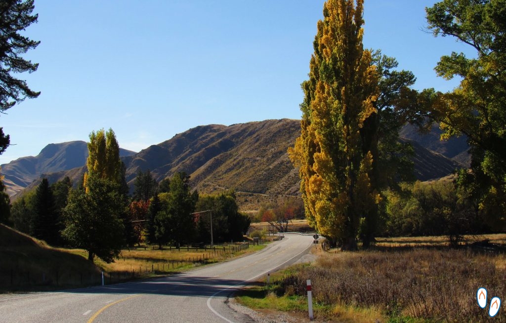 Lindis Pass, South Island of New Zealand
New Zealand has beautiful landscapes from North to South. If you are arriving at the website just now and need help planning a complete tour in New Zealand, check out the post New Zealand: a trip through this amazing country. You can also read the post North Island of New Zealand.
Our South Island tour started in Christchurch, New Zealand’s 3rd largest cisty. Then we crossed the country to Franz Josef, passed through the lake region and ended up in Queenstown. At total it were 12 days of scenic roads and amazing landscapes.
Since we didn’t had that much time, we ended up setting aside the North region of the South Island, where there are some beautiful beaches in the Abel Tasman National Park, Golden Bay, Nelson, among others. Those are destinations I definetly want to visit in my next trip to New Zealand.
So we took a flight from Auckland to Christchurch, and rented a car there from Apex.
Christchurch and Banks Peninsula
Christchurch is the largest city in the South Island of New Zealand. It is a charming, “english-like” city, mixing some of the oldest buildings in New Zealand with a cutting edge architecture. If you enjoy walking, we recommend a visit to Hagley Park.
Unfortunately, we didn’t get to know Christchurch much. We stayed there only for a couple of days and the city was all under construction, as it was recovering from the 2016 earthquake.
But since Chirstchurch is located in the heart of the Canterbury region, we used it as a base to explore this beautiful area of New Zealand’s South Island, specially the Banks Peninsula.
Activity options near Christchurch
 Christchurch, city in the South Island of New Zealand
The South Island of New Zealand is full of nature all around. The Canterbury region is no different. The number of trails around Christchurch is immense. For those who want to explore the region on foot, you can check out this website.
We chose to take a boat trip to observe marine life. This is a kind of activity offered in many cities in the east coast. The most famous place in the Canterbury region to observe marine life is Kaikoura, which is 2h30 away from Christchurch by car. However, we were unable to schedule tours in Kaikoura as they were already fully booked.
Akaroa
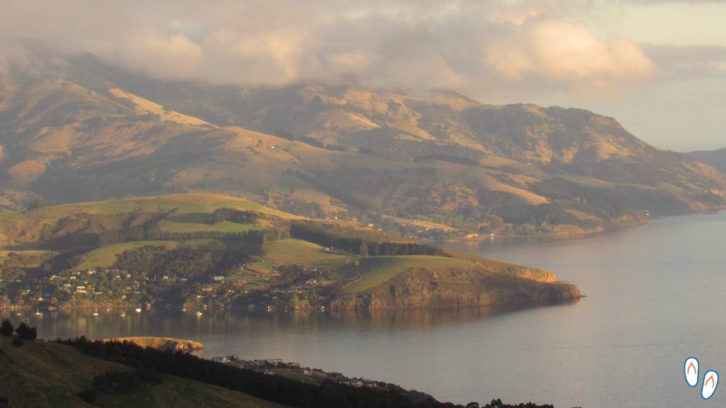
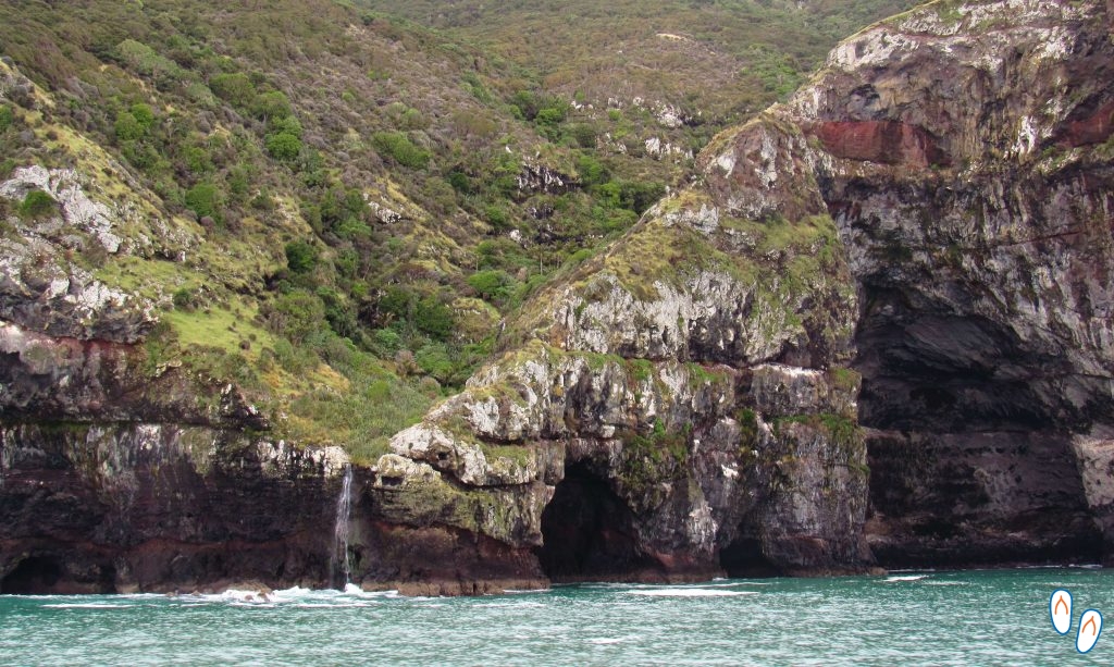
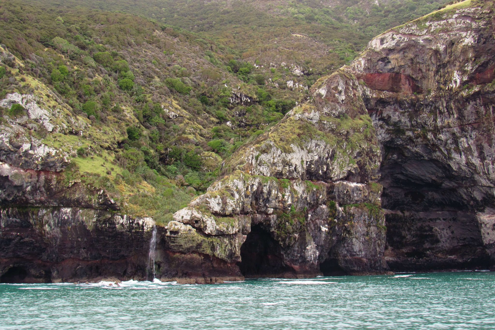
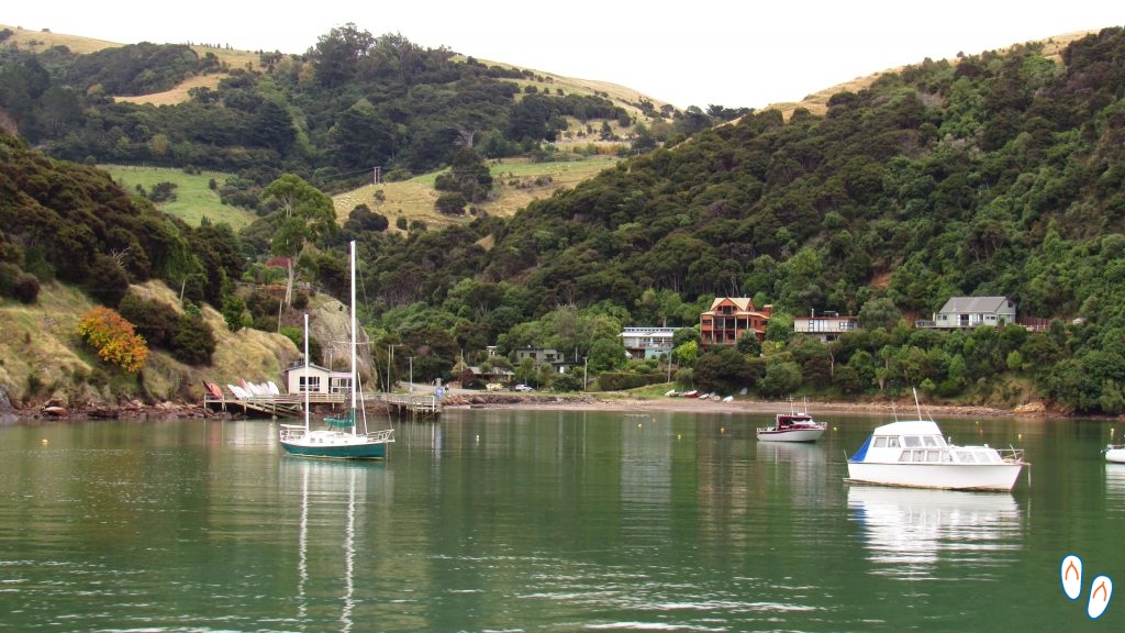 Akaroa, located on the Banks Peninsula, New Zealand
We then hired a boat trip in Akaroa, which is much closer to Christchurch, on the Banks Peninsula. We chose the Akaroa Harbor Nature Cruise from Black Cat Cruises, which cost NZD 85.00 per adult. It was an amazing ride, with sightings of dolphins, seals, birds and even a penguin!
Akaroa is a charming port city with French colonization. Due to its location right in the middle of the Akaroa Harbor channel, it is an excellent location for boat trips. In addition to the marine life, the visitor also contemplates the beautiful view of the bays along the canal.
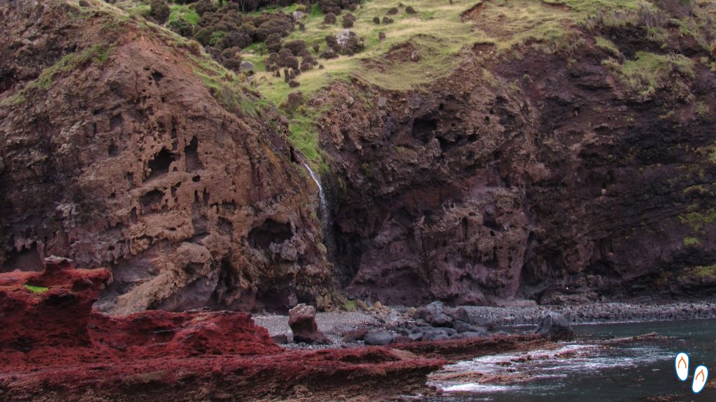
 “Stone elephant” – rock formation on Banks Peninsula
The dolphin present in the region is the Hector’s Dolphin, an endemic species from New Zealand, which is considered the smallest dolphin in the world. In Akaroa it is even possible to hire tours to swim with the dolphins from renowned and responsible companies.
For those who have more time to explore the Banks Peninsula, there are several options of trails in the region that can be made to contemplate the beautiful topography of the peninsula.
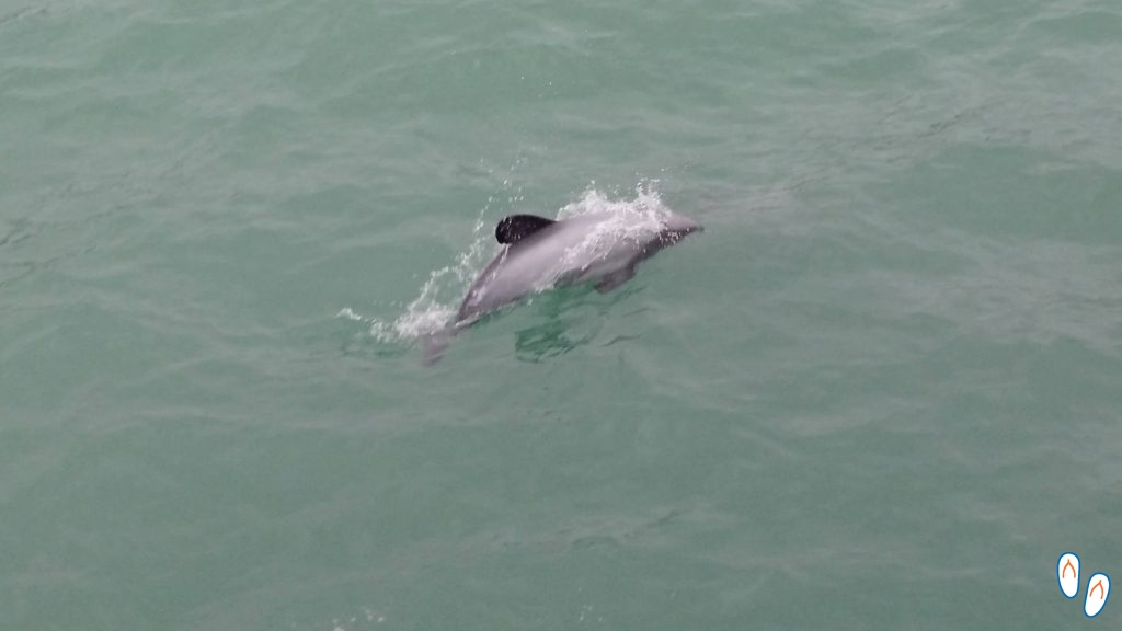
 Hector’s Dolphin, the smallest dolphin in the world – endemic from New Zealand
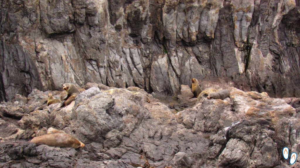
 Sea lions spotted from Akaroa, New Zealand
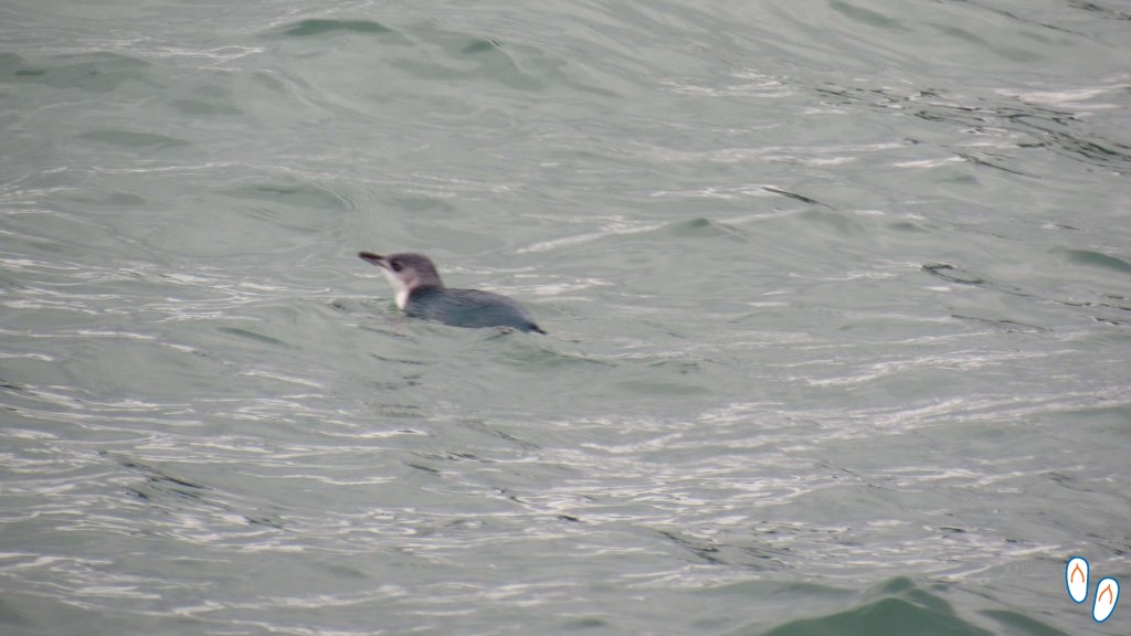 A lone penguin swimming in the middle of Akaroa Harbor
After the boat ride, we took a walk through the friendly city of Akaroa, had lunch and took the road back to Christchurch. The panoramic view of the road to Banks Peninsula itself is very beautiful. We also made a quick stop on the way back, to contemplate the beautiful Lake Forsyth, with the mountains in the background.
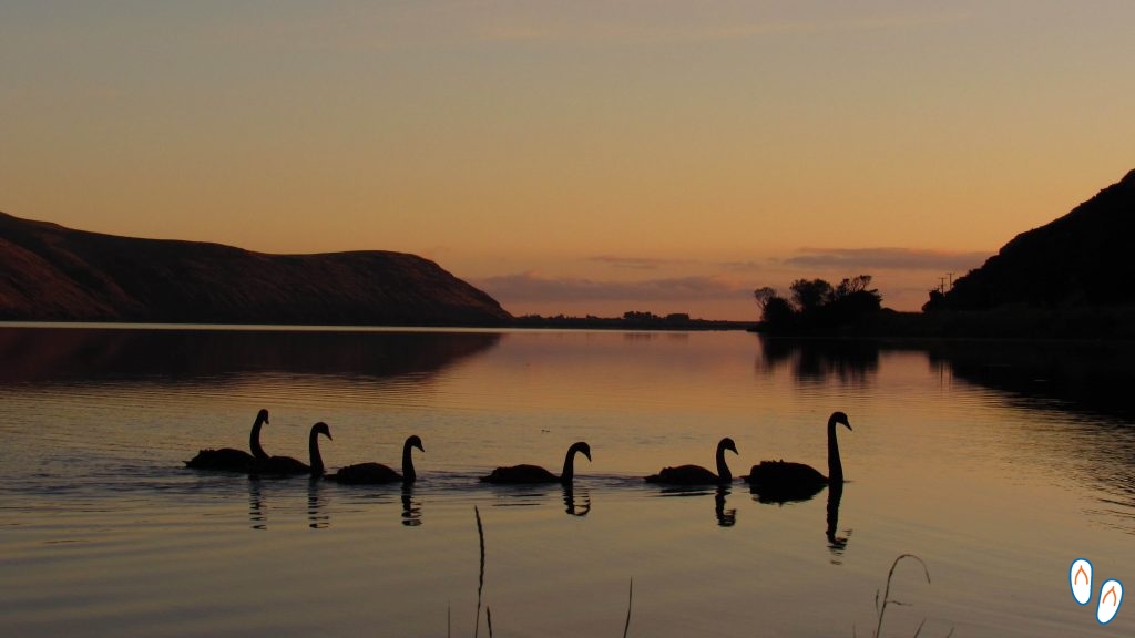 Lake Forsyth, on the road from Christchurch to Akaroa. We were lucky to see this beautiful family of black swans crossing the lake in the late afternoon. The photo location is near Little River Freedom Camp.
The evening look at Lake Forsyth was the perfect way to end the day. The next day, we would travel to the West Coast, crossing New Zealand’s South Island by the Great Alpine Highway.
Great Alpine Highway
 Great Alpine Highway: beautiful view all the way!
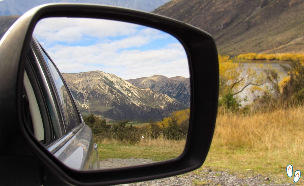
Leaving Christchurch, we started our road trip across New Zealand’s South Island to the West Coast. We drove along State Highway 73 – also known as the Great Alpine Highway – passing thru beautiful landscapes like Arthur’s Pass National Park.
In fact, I recommend the route to Arthur’s Pass even for those who don’t intend to cross all the way to the West Coast. The Great Alpine Highway from Christchurch to Arthur’s Pass is one of the most scenic roads of New Zealand. It took us 2 hours by car, but it can also be done by train by TranzAlpine.
I will describe below some of the main points of interest in the Great Alpine Highway.
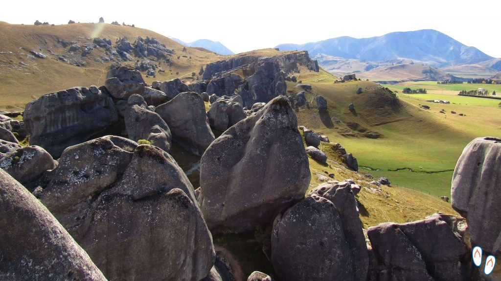
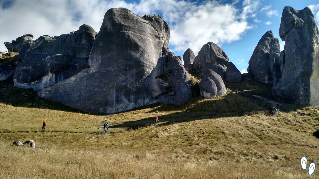
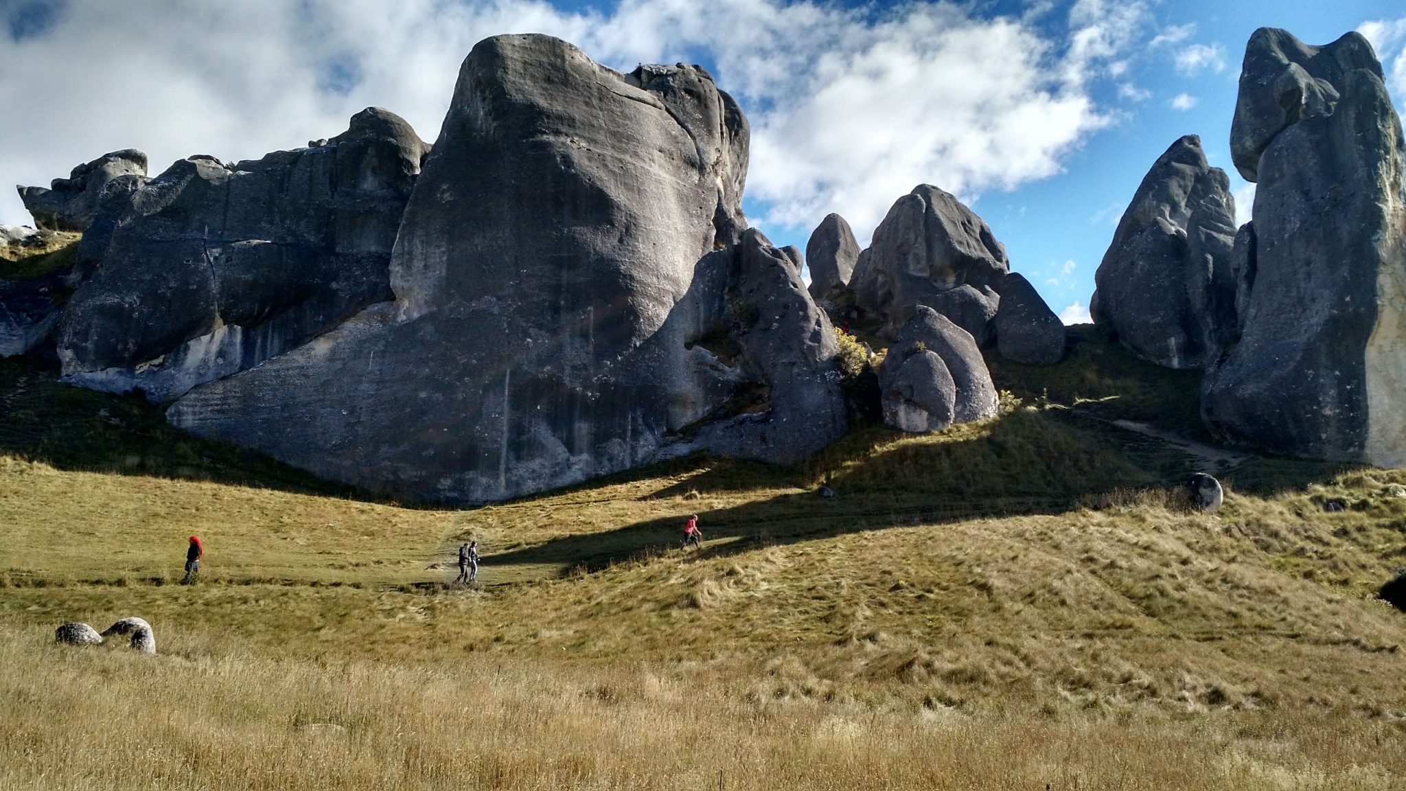
1st stop: Kura Tawhiti / Castle Hill Conservation Area

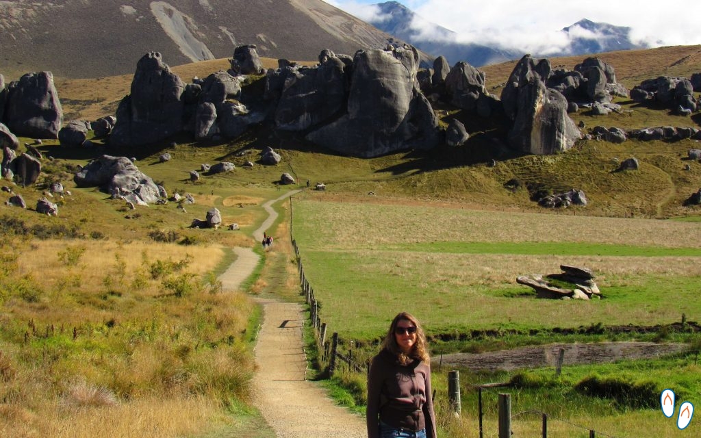 Kura Tawhiti Conservation Area, Castle Hill, in Great Alpine Highway, South Island of New Zealand
At 95km from Christchurch, Kura Tawhiti is a conservation area in the center of the Great Alpine Highway. Its huge limestone rocks impress any traveler who passes by.
The entrance to the park is free and the visitor can climb to the top of the rocks from where you have a sensational view. This incredible scenery was used in the filming of The Chronicles of Narnia.

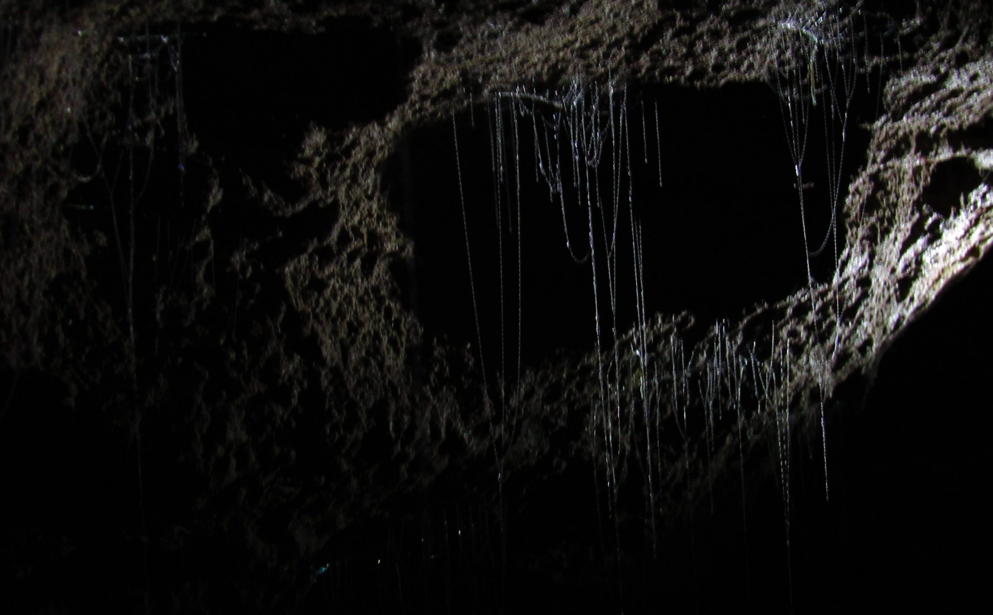
2nd stop: Cave Stream Scenic Reserve
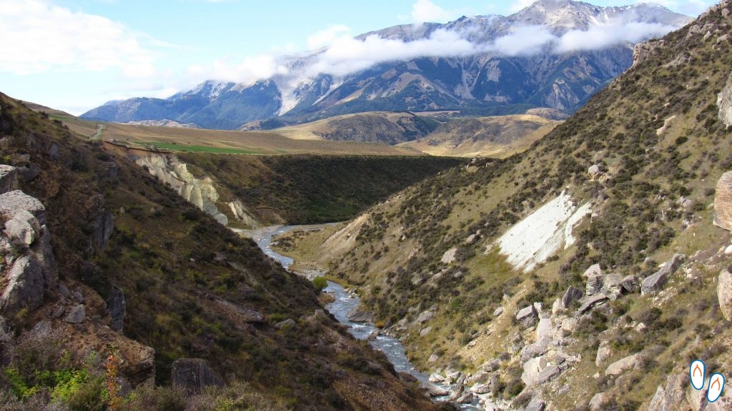
 Cave Stream Scenic Reserve, in Great Alpine Highway, South Island of New Zealand
Going on for another 6.5km is the Cave Stream Scenic Reserve, or Broken River Cave. It is a 594m cave with deviations and curves that makes the interior of the cave completely dark.
A small river passes through the cave. Although seemingly harmless, you have to be very careful if you intend exploring the cave. Depending on climatic conditions, the temperature and depth of the river may vary. The river also passes through some waterfalls inside the cave.
 The cave of almost 600m in length can be crossed from end to end with proper preparation and equipment.
The place is very beautiful and worth visiting, even reaching the entrance to the cave. However, to cross its entire length, it is necessary to consider the conditions and be properly equipped.
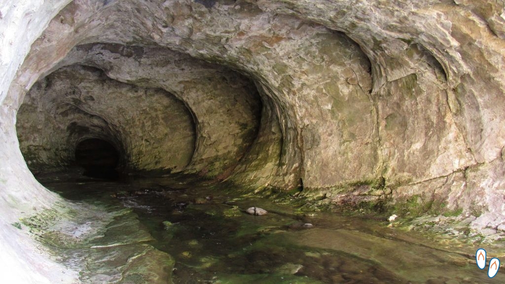
3rd stop: Lake Pearson
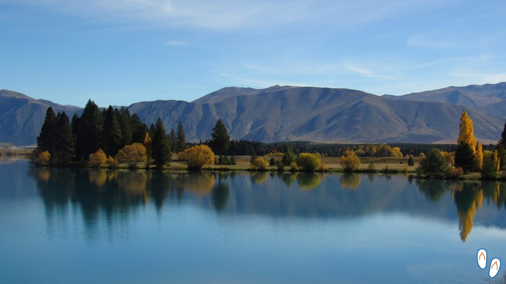
 Beautiful view of Lake Pearson in autumn – one of the beauties of the Great Alpine Highway
After driving for another 13km on the Great Alpine Highway, we arrived at the beautiful Lake Pearson. Lake Pearson, due to its darker color, usually reflects the surrounding landscape. As our visit there was in Autumn time, the scenery was beautiful with the leaves of the yellowed trees on the edge of the lake.
The site has a camping spot.
4th stop: Arthur’s Pass National Park
 Waimakariri River, in Arthur’s Pass National Park.
After passing Lake Pearson, in just over 30km the Great Alpine Highway enters the area of Arthur’s Pass National Park. The park covers a mountainous area of more than 1000 km2, and is home to different and rare species of animals and plants. As an example, the colorful mountain parrot, known as Kea, an endemic bird from New Zealand.
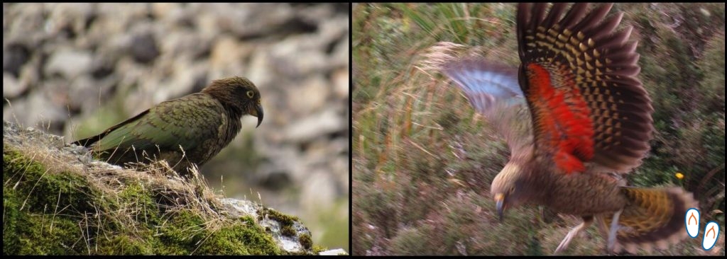 Mountain Parrot, or “Kea”, on Arthur’s Pass, near the Great Alpine Highway
Arthur’s Pass National Park offers a good range of both short and long trails. An example is the Devils Punchbowl Walking Track, a trail of approx. 1 hour, which reaches a 130m high waterfall. To download the park’s brochure and check other trail options, click here.
For those who are not interested in the park trails, at least it’s worth stopping at the Otira Viaduct Lookout.
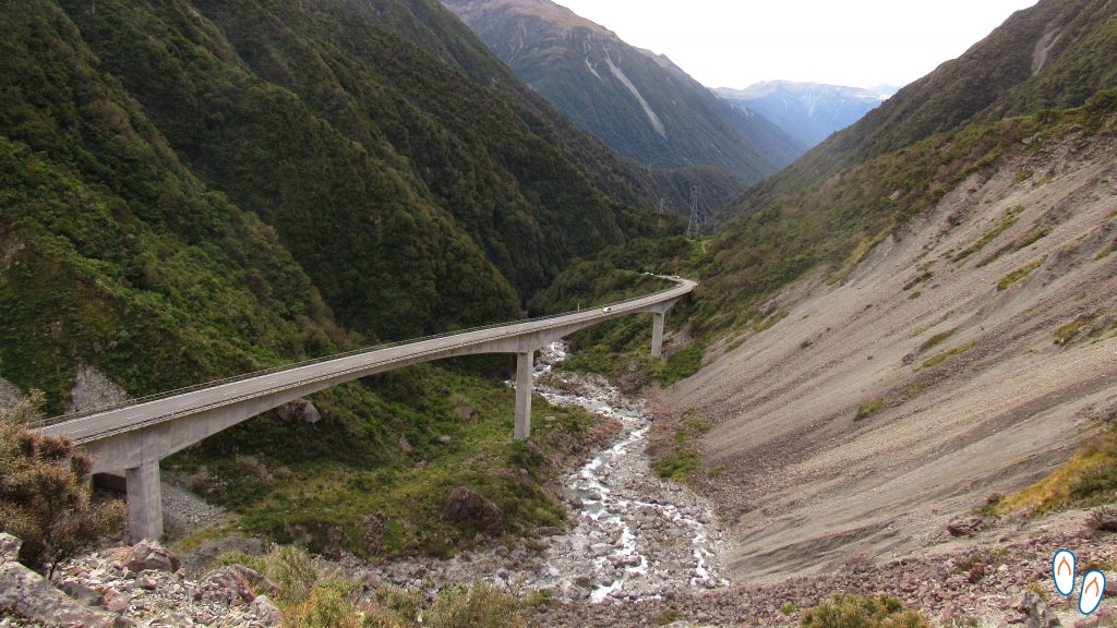 Otira Viaduct, opened in 1999, next to Arthur’s Pass
Traveling New Zealand’s West Coast
 View of State Highway 6, during our ‘road trip’ through New Zealand’s West Coast
After passing Arthur’s Pass, we continued on the Great Alpine Highway for another hour, until we reached State Highway 6 (SH6), a highway that crosses New Zealand’s West Coast. We drove south in the SH6 for another 150km to our hotel in the city of Franz Josef. We were ansious to visit New Zealand’s glaciers.
Another path we could have taken was driving north in the SH6, and reach Westport, passing for a coastal and scenic road with beautiful landscapes. One of the famous points of interest on this path is the Paparoa National Park.
On our way to Franz Josef, we made a final stop at the Hokitika Gorge, a place for contemplating the Hokitika River. The Hokitika River is formed by glacial waters and therefore its blue color draws a lot of attention among the darker vegetation.
In Franz Josef, we stayed at Glenfern Villas, where the accommodations were very comfortable well-equipped.
 Animals at Glenfern Villas Hotel, in Franz Josef, west coast of New Zealand
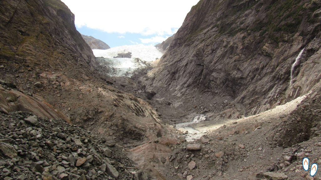
Franz Josef Glacier
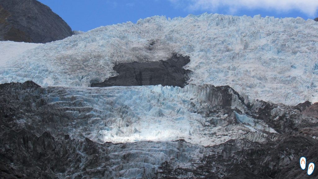 Franz Josef Glacier
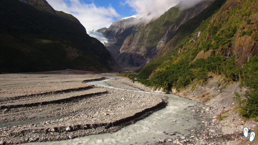
We started the day by visiting Franz Josef Glacier, one of the most popular glaciers in New Zealand. From our hotel it was only 10min to the parking lot. Leaving the main road (SH6), we only had to drive for another 3.5 km to the glacier.
We made the trail Kã Roimata o Hine Hukatere Walk, of approx. 5.5km (round trip). The trail passes by the middle of the temperate forest of the Westland Tai Poutini National Park and goes to the viewpoint from where you can see Franz Josef Glacier. A guide is not required for this trail. Some travel agencies offer this service, but we found that the trail is exactly the same as the one you do on your own.
 Part of the path taken to see the Franz Josef Glacier up close
I confess that by having seen photos of Franz Josef Glacier previously, I had a very high expectation of the view and was a little disappointed. It turns out that Franz Josef Glacier, like other New Zealand glaciers, is shrinking in size very quickly.
Fox Glacier
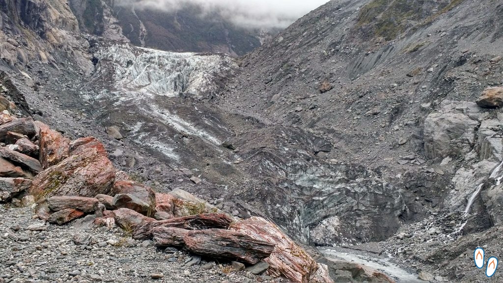 Fox Glacier, seen from the viewpoint – over time, the glacier receded and debris began to cover it
In the same day, we took the SH6 again, now to visit Fox Glacier. Fox Glacier is approx. 30km from Franz Josef Glacier. Like Franz Josef, Fox Glacier is also next to a city that bears his name. Leaving the main road, it is about 3 km to the parking lot.
Right next to the parking lot, there was a beautiful turquoise lagoon, which is an attraction itself.
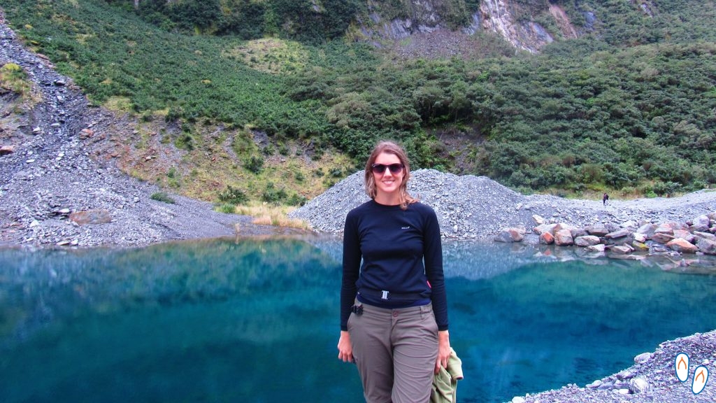 Blue and super transparent water lagoon on the way to Fox Glacier.
The trail to Fox Glacier lookout is about 2.6 km long (round trip), and easy level. Guide accompaniment is not required. The trail passes through the valley, for the most part, in an open area and crosses some streams. The final section has an uphill from where the glacier can be seen.
Compared to Franz Josef, the Fox Glacier, although smaller, can be seen more closely. I find it interesting to visit both of the glaciers, the vision of the 2 glaciers is complementary in a way.
About New Zealand’s glaciers
 Franz Josef Glacier – the view from the lookout can be disappointing
Some travel agencies offer tours to Fox and Franz Josef glaciers. Before hiring, get well informed about the activity, what it includes and the level of preparation required.
The tours are usually very expensive because currently any activity that takes the visitor to the glacier involves transport by helicopter.
The only options without a helicopter are the trails to the lookout, with a view to the glaciers, in which case you don’t walk on the glacier. But these same trails can be done free of charge without a guide. In the case of Fox Glacier the guide can take you a little closer to the glacier, but this will depend a lot on the conditions.
Glaciers are in motion all the time, so it’s important to always stay on the marked trail, observe the conditions of the place and obey the signs of the park.
 Comparação do Fox Glacier nos anos de 2008 e 2014 – os efeitos do aquecimento global são notáveis com o recuo dos glaciares.
Both Franz Josef and Fox Glaciers are part of the Westland Tai Poutini National Park. Like all New Zealand national parks, admission is free.
On our visit to these 2 glaciers in New Zealand, the effects of global warming were quite evident as both have drastically reduced in size in recent years. New Zealand, due to its large cattle ranching, is a country with a high CO2 emission and this makes warming faster in the country.
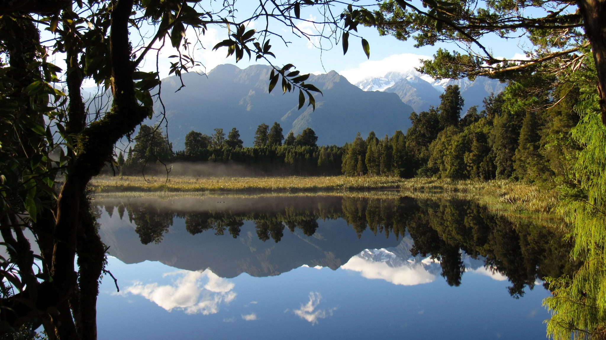
Matheson Lake
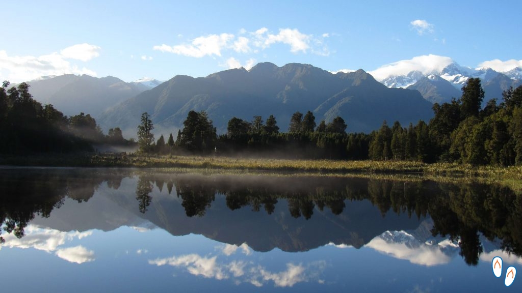 In good weather, the reflection in the waters of Matheson Lake is perfect! The lake’s surface even reflects the fog!
About 10km from Fox Glacier, is one of the most incredible landscapes on New Zealand’s South Island. I’m talking about Matheson Lake, that due to its darker coloration, when the water is still, reflects the surrounding landscape in an impressive way.
The trail that runs along the Matheson Lake perimeter is a circle and is 2.6 km in total. There are some viewpoints scattered along the trail, if you have time I recommend stopping at all of them.
 This was the look of Matheson Lake on the 1st visit – cloudy day and without the effect of the reflection!
We had to visit Matheson Lake twice to get to see the reflection that way. On our first visit, the view was beautiful, but nothing exceptional. However, when we returned the next morning, the image we saw was like this:
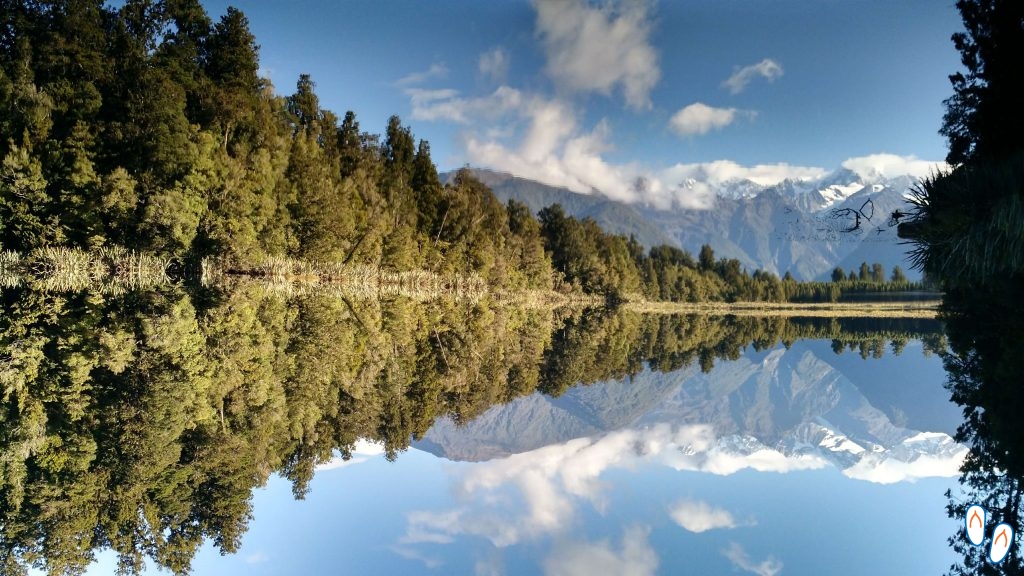 Did you notice the branch “floating” in the air? In front of the mountain? What is the magic? This branch is actually on the surface of the lake – and the photo is reversed! It’s difficult to differentiate the original image from the reflection, right?
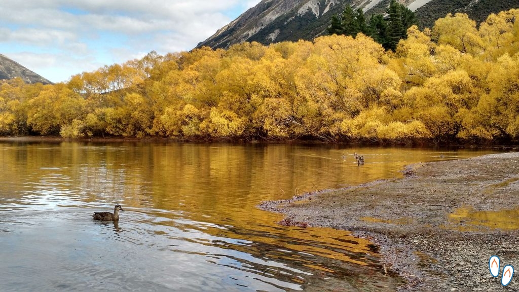
The lakes of New Zealand

Glenbrook, on State Highway 8, on the way between Wanaka and Lake Pukaki.
Heading south, our next destination was Wanaka. It was approx. 270km away from Fox Glacier. The trip led us to State Highway 6, on another stretch of the scenic neo zealander roads, crossing the middle of Mount Aspiring National Park.
This stretch would take about 3h30 of travel, but as in New Zealand there is always something fantastic along the way, we made 2 stops:
Thunder Creek Falls
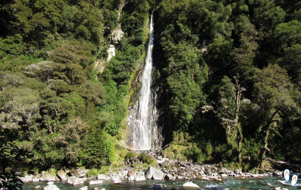 Thunder Creek Falls, in State Highway 6, no Mount Aspiring National Park.
Thunder Creek Falls is a 96m high waterfall that supplies Haast River. The waterfall is 170km from the city of Fox Glacier. The parking lot is located on the side of the highway itself. The sign is very discreet so it’s very easy to pass by it unnoticed. From the parking lot, there’s a 5min walk to the waterfall. The path goes by an easy and demarcated trail.
 A section of Haast River, where Thunder Creek Falls flows.
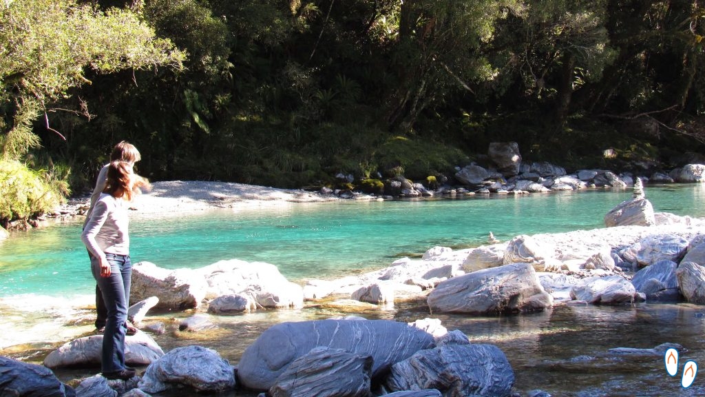
Blue Pools
Blue Pools – natural pools of crystal blue water, from the melting glaciers of Mount Aspiring National Park.
Continuing for another 20km along the SH6 towards the south, you will find another interesting stopping point: the Blue Pools.
The Blue Pools are natural pools of transparent water from Makarora River. The river runs along a stretch parallel to the SH6 road, and ends at Lake Wanaka.
The crystal blue waters of Blue Pools, also called Makarora Pools, have this color because they come from melting glaciers from the top of Mount Aspiring. Due to its glacial origin, swimming in the Blue Pools can be very dangerous. Low temperatures can reduce or even stop your body’s movements. I’d suggest taking it as a contemplative place.
 Blue Pools – Photo taken on the same day as the previous photo – evidence of how lighting affects the look and color of the water.
As in Thunder Creek, to visit the Blue Pools, you will see the parking lot right next to the road. The trail from the parking lot to the natural pools is about 20 minutes passing through a beautiful forest covered with moss.
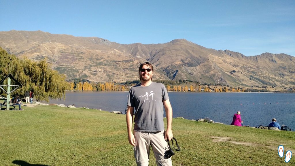
Wanaka
 City of Wanaka, South Island of New Zealand
Following SH6 for another hour, we arrived at Wanaka.
Wanaka is a charming town located at the southern end of Lake Wanaka. The city is close to Mount Aspiring National Park, and offers a variety of activities for each season. On lakewanaka.co.nz you can find more information.
Wanaka is very popular in winter due to its ski resort. Although in the summer it also receives many tourists who use the lake for water sports.
 Lake Wanaka – an excellent place to practice water sports, or even to relax and have a picnic.
Wanaka is certainly a destination for any season, even if it is just to relax in front of the lake and admire the landscape.
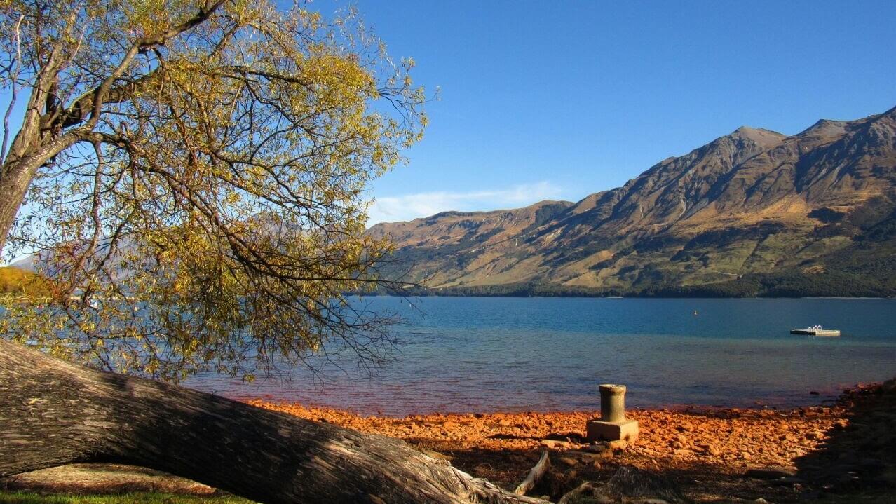
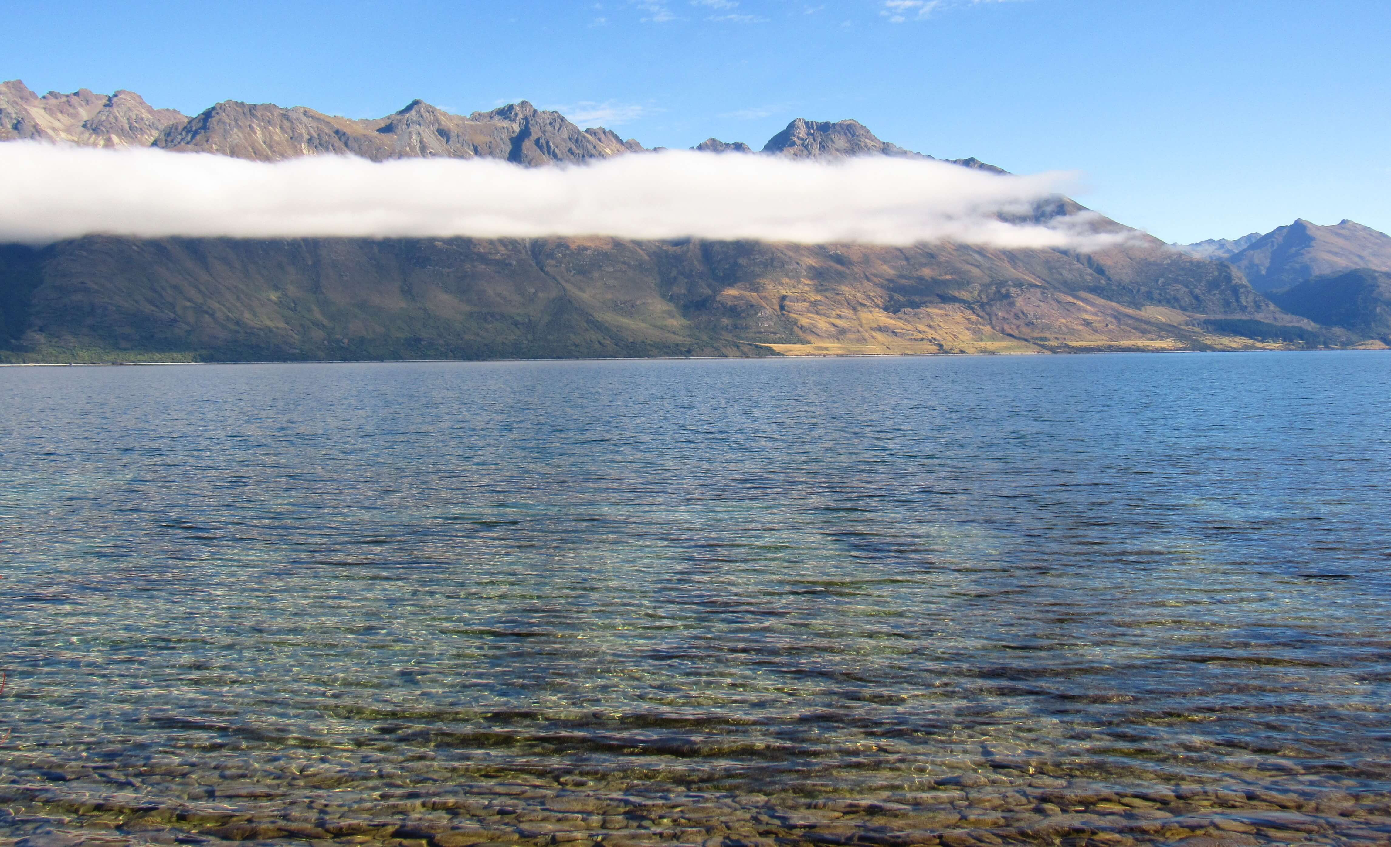
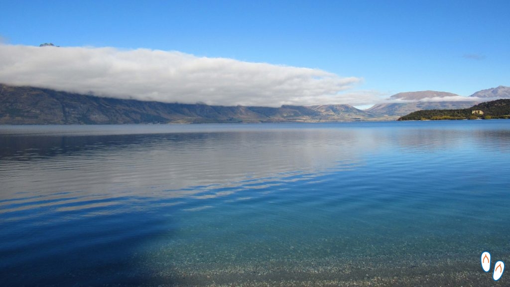
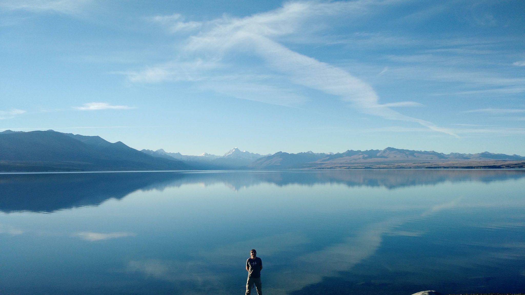
We used the city of Wanaka as a base to visit other beautiful New Zealand lakes, like Lake Pukaki and Lake Tekapo. To head towards these 2 lakes, you need to take State Highway 8.
The path between Wanaka and Pukaki passes through the scenic Lindis Pass landscape and the Glenbrook area.
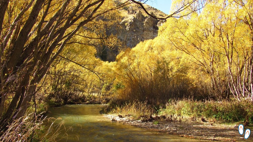 Brook in the Lindis Pass region
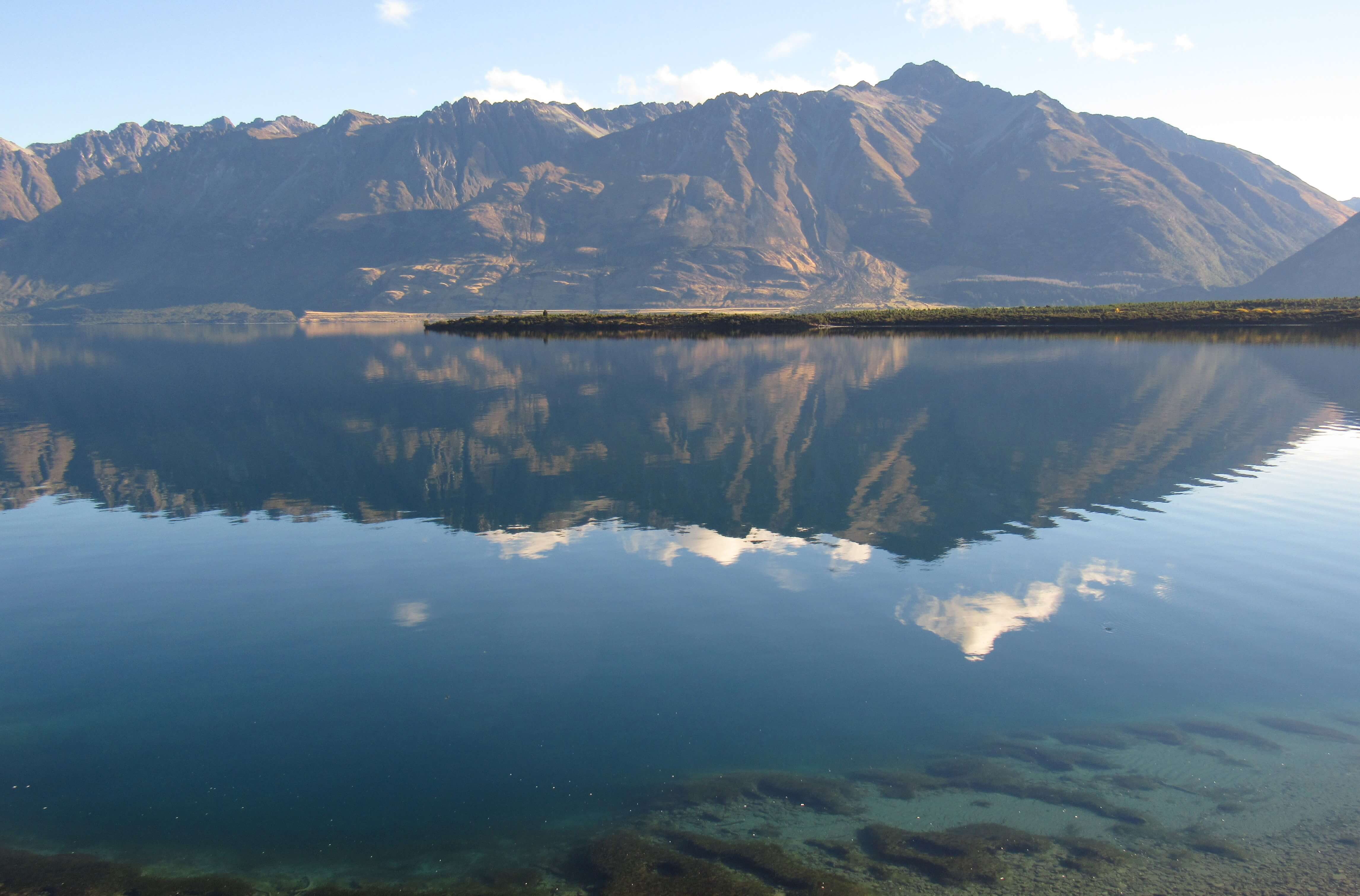
Lake Pukaki
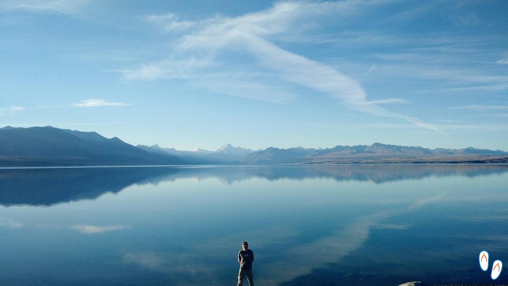 Lake Pukaki, New Zealand – in the background, you can see Mount Cook.
Lake Pukaki, along with Tekapo and Ohau lakes, form a cluster of alpine lakes on the South Island of New Zealand. The 3 lakes are shaped by the melting of glaciers. Its shape and color are associated with the movement of glacial debris that blocked the valleys, preventing the water from flowing.
Lake Pukaki is the largest, and is also the closest to Aoraki / Mount Cook National Park. Mount Cook is New Zealand’s highest point. For those interested in hiking in Mount Cook National Park, it’s worth checking out the options on NZ’s government offical website. To make the longer trails, a good option is to use the city of Twizel as a base.
 Lake Pukaki, New Zealand
When you take State Highway 8 (SH8), right next to Twizel, you’ll naturally pass by Lake Pukaki, from where you already have a beautiful view. But it’s worthwhile to enter State Highway 80, and go on to Peter’s Lookout, a viewpoint almost in the center of the lake.
Lake Tekapo
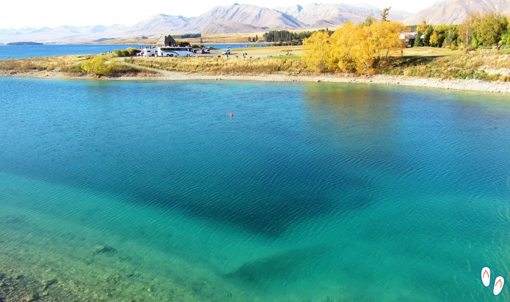 Lake Tekapo, New Zealand
Driving for another 50km on SH8, you’ll find Lake Tekapo, how is called the small town on the edge of Lake Tekapo. Lake Tekapo has an incredible view, with its turquoise blue water in the mountains of the Southern Alps.
As we were in autumn time, the yellowed trees next to the blue Lake Tekapo formed a beautiful and colorful landscape.
 Lake Tekapo, New Zealand
At the top of the hill is the Church of the Good Shephard, a friendly chapel with a view to Lake Tekapo and the mountains of the Southern Alps.
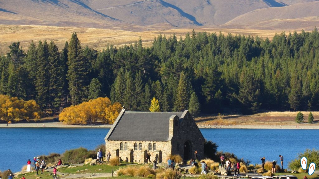 Church of the Good Shepard, capela em frente ao Lago Tekapo. De dentro se tem uma vista para o lago com as montanhas ao fundo.
Close to Lake Tekapo is Mount John Observatory, a place where astronomical tours are made to observe the stars. To arrive at the observatory, a fee of NZD 8.00 per car is charged. Unfortunately we were unable to go but we heard that it is worth visiting the place even in the daytime as the view is wonderful.
Queenstown and Te Anau

 Devil’s Staircase, one of the most beautiful places on the Road from Queenstown to Te Anau
Leaving Wanaka, we took the road south towards Te Anau, passing through Queenstown. Te Anau is a small town on the doorstep of the Fiordland National Park, a region in the southwest of the South Island, where the fjords of New Zealand are located.
From Wanaka to Te Anau it is approximately 230km, and once again the trip goes through beautiful landscapes that deserve to be photographed.
Milford Sound and Fiordland National Park
But what is a fjord anyway? A fjord is a long and winding “arm” of the sea, usually in between mountains. Milford Sound is New Zealand’s most visited fjord. Of its “brothers” within Fiordland National Park, Milford Sound is the most famous and accessible, as it is possible to reach it via State Highway 94.
There are other fjord options in the region, such as Doubtful Sound. However, the logistics are a little more complicated. Doubtful Sound is the deepest of the fjords, and also one of the longest. To access it, the starting point is the city of Manapouri, from where you have to cross Lake Manapouri by boat.
How to get to Milford Sound?
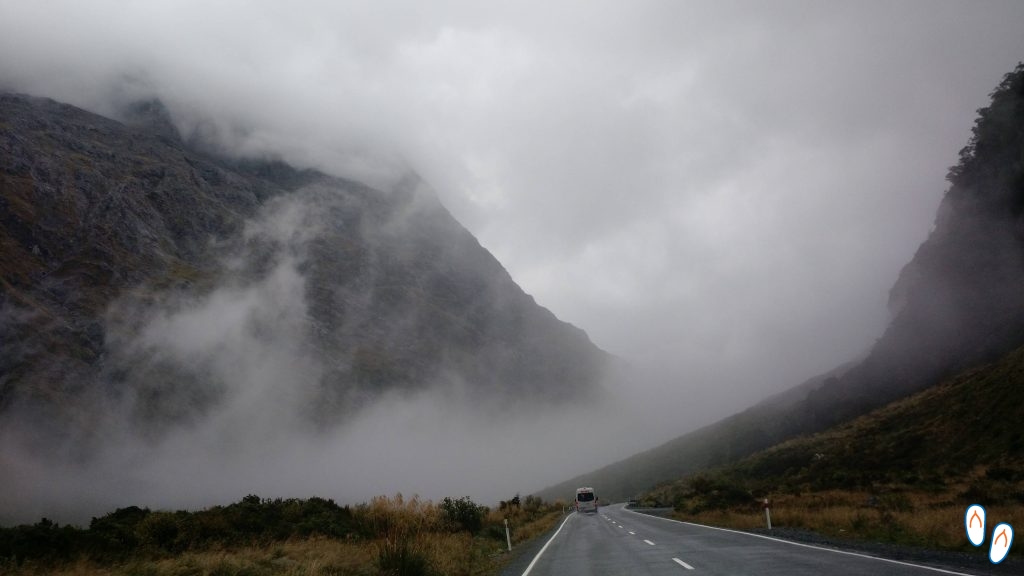 The bad weather on the trip to Milford Sound damaged the landscape on the road and ended up preventing us from stopping in some places.
The closest town to Milford Sound is Te Anau, where we stayed for 2 nights in an AirBnb. Milford Sound is almost 2 hours by car from Te Anau, it’s 120km through Milford Road (SH94).
Anyone staying in Queenstown can take the InterCity bus to Milford Sound. However, it takes more than 4 hours to travel, and you end up limiting the boat tour times.
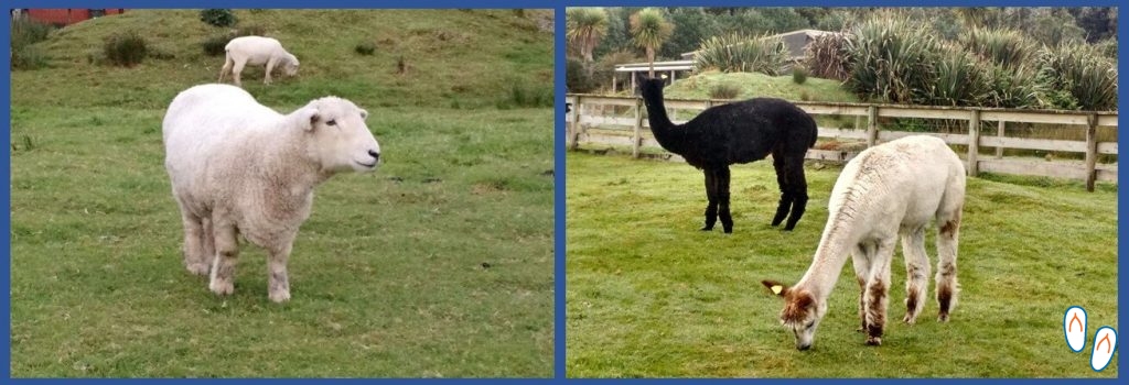
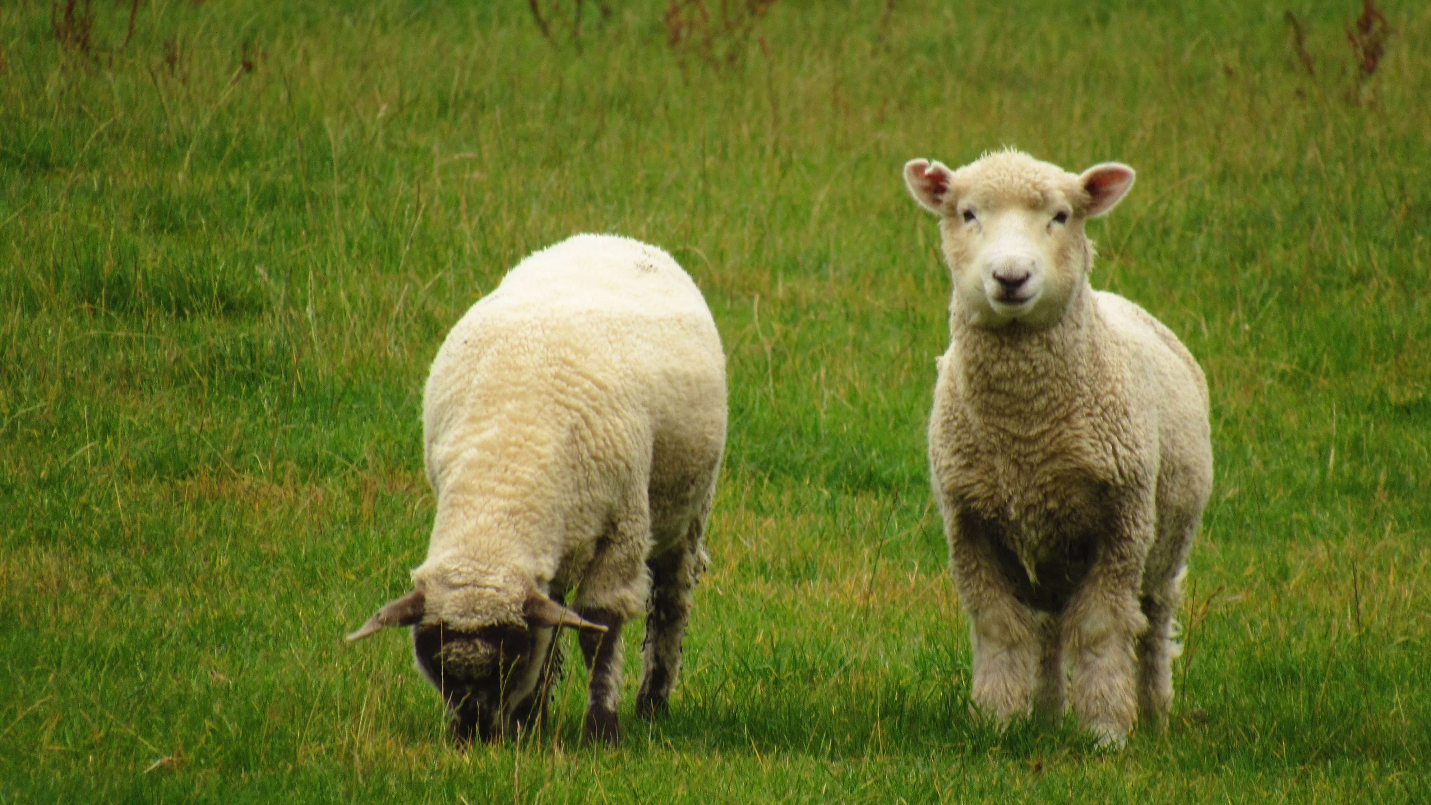
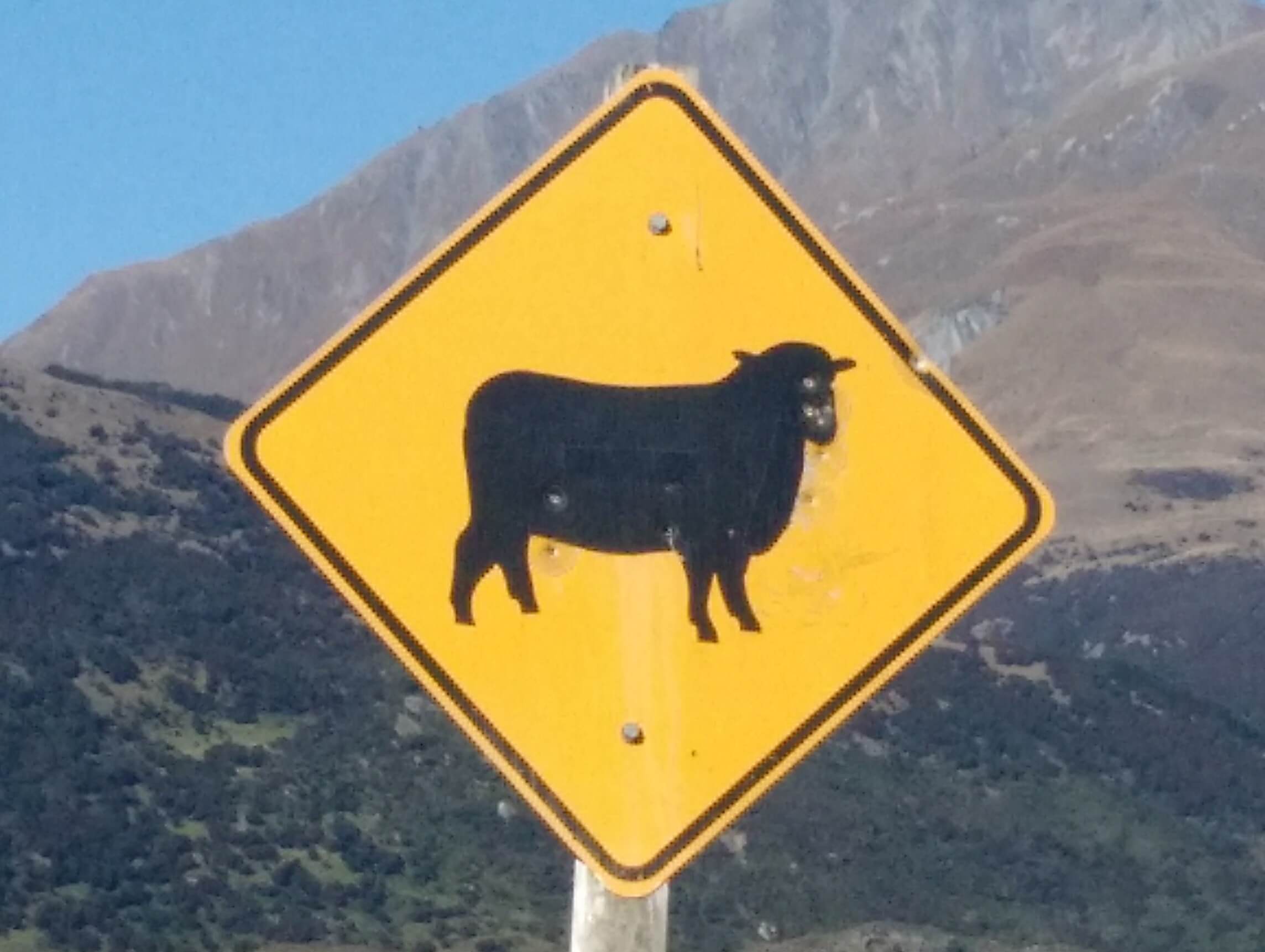
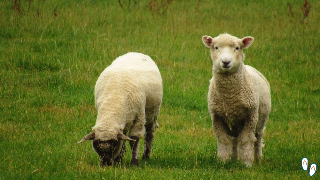 As in all of New Zealand, the road to Te Anau is full of sheep!
If you are going to Milford Sound by car, don’t forget to fill the tank: the last gas stations are in Te Anau.
On the way to Milford Sound, there are several points of interest with short walks that are worthy to stop, the main ones are:
Mirror Lakes
 Mirror Lake, one of the stopping points on the road to Milford Sound, inside Fiordland National Park
Approximately 60km from Te Anau is the entrance to Mirror Lakes. It is not difficult to understand the reason of the name: the reflection of the lake is perfect.
To get there, just park beside the highway, in the marked spaces, and follow a short and easy trail through a wooden platform. The lake is literally beside the highway.
 Mirror Lake, in Fiorland National Park, entrance from Te Anau to Milford Sound
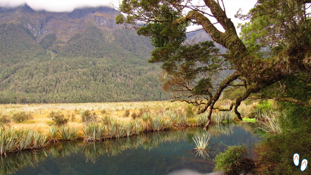
Cascade Creek / Lake Gunn
After passing Mirror Lakes, continue for another 18km (towards Milford Sound) to Lake Gunn Nature Walk. The entrance is just after a small bridge.
The 1.4km circle trail starts at Cascade Creek, a stream of green and crystal clear water. The walk passes through many trees and Lake Gunn, from where you can see a beautiful view with mountains in the background.
Homer Tunnel
The Homer Tunnel is a 1.2km long tunnel that is on Milford Road itself, about 25km from Cascade Creek. The tunnel is 3.8m high and originally was all gravel. Before being transformed into asphalt, it was the largest gravel tunnel in the world.
The Homer Tunnel is considered a landmark as an engineering work for its extension, since it was mostly dug by hand, and in a remote location with difficult conditions. Its completion took almost 20 years. Partly because of its interruption during World War II, but also partly because of the avalanches that threatened the area. Workers had to sleep in tents in an icy, mountainous area, where there’s hardly any sun for much of the year. Some even died in the avalanches, and many were injured with rocks that rolled from the mountains.
Even today, the tunnel is a single lane, and its traffic is released through a traffic light, at predetermined times. The surrounding landscape is magnificent, full of snowy mountains. At the east entrance (closest to Te Anau), there is a space on the right side for parking. Depending on the time of year, you can see glaciers over the mountains, forming cascades of snow on the stone walls.
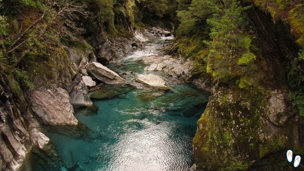
The Chasm
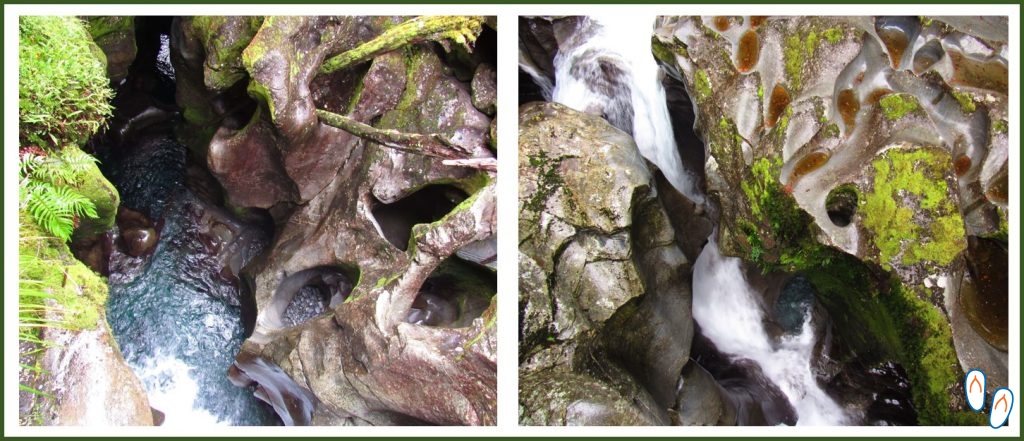 The incredible view of the Cleddau River shaping the rocks and forming a canyon in ‘The Chasm’
At approximately 8km from Homer Tunnel (towards Milford Sound), is The Chasm Walk. It is a small trail that crosses 2 bridges overlooking the course of the Cleddau River.
The river goes down its course passing some violent falls, forming a series of waterfalls. It’s impressive to see the formations of the stones that were shaped by the force of the water.
The trail is easy, accessible, and is about 400m long. There is ample parking space on the left for those heading towards Milford Sound.
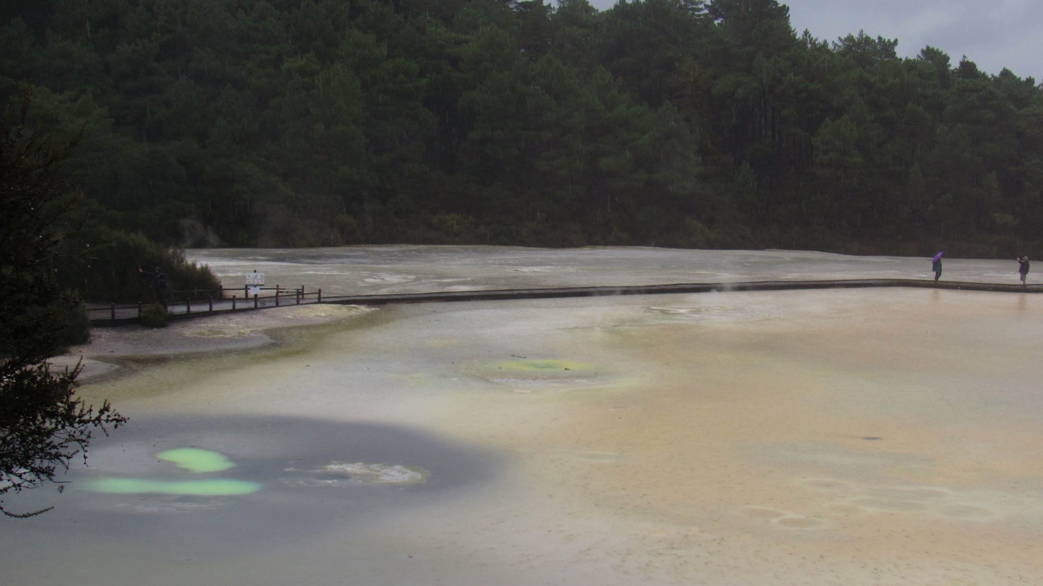
What to do in Fiordland National Park?
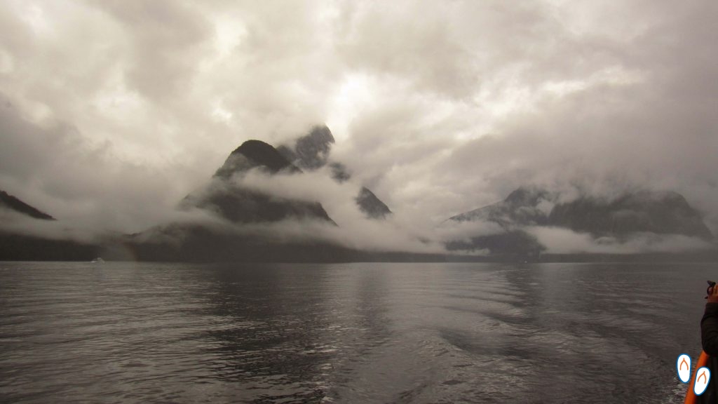 Our tour in Milford Sound – the fog took over and the visibility of the tour was terrible.
The most popular activities in the fjords are boat and kayak tours, to contemplate the giant mountains rising from the sea. Normally also part of the tour is the sighting of marine life, such as seals and bottlenose dolphins.
An important tip: book the tour a few days in advance, but check the weather forecast. On rainy and foggy days, the visibility is terrible. Companies hardly ever cancel the tours, unless the safety of the tour is at risk.
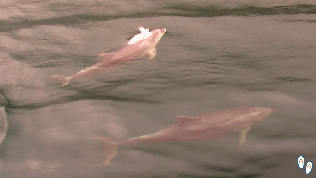 Bottle-nosed dolphins passing by our boat at Milford Sound
There are several companies that offer boat trips in the fjords. We hired Go Orange, for NZD 45.00 per person. It was a 2-hour tour, leaving at 9 am. Unfortunately, the fog occupied the entire area and we couldn’t even see the mountains. We still want to go back to this place to be able to see the fjords appropriately.
For the more adventurous, Fiordland National Park offers several hiking options – most of them more demanding. You can check more details on the park’s website.
Te Anau Bird Sanctuary
If you are staying in Te Anau, take the opportunity to visit Te Anau Bird Sanctuary. The site is a sanctuary for native birds that have suffered some type of injury and are still unable to survive in the wild.
Te Anau Bird Sanctuary is free, but you can make a contribution to help maintain their work.
One of the “stars” of the place is the Takahe, a bird endemic from New Zealand, now threatened with extinction.
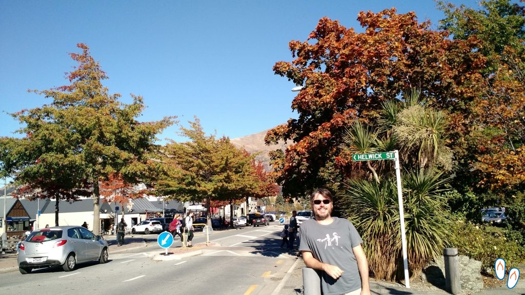
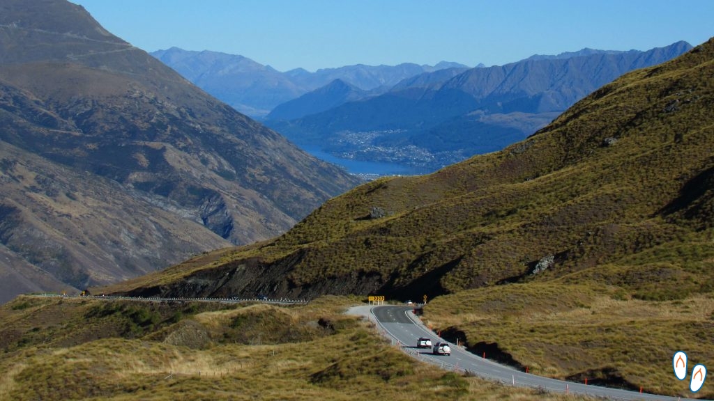
Queenstown
 Arriving in Queenstown!
After another 170km of tireless road trip…we finally arrived at our last destination in New Zealand! Yes, I am referring to the world capital of adventure and extreme sports, Queenstown!
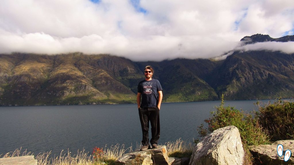
Queenstown is located on the shores of Lake Wakatipo, on the South Island of New Zealand. The view from inside the city is magnified by the proximity of the mountains called The Remarkables.
During the winter, many people practice skiing and other winter sports at the Remarkables.
Although well known, Queenstown has a population of only 15,000 inhabitants and is classified as a ‘resort town’, a name designated for places that live of tourism.
People who live there have told us that “nobody comes from Queenstown”. I don’t know about that, but it is really noticeable how many people come from other countries or other regions of New Zealand. Many people who live in Queenstown today are there for an exchange, internship or Working Holiday.
Where to stay in Queenstown
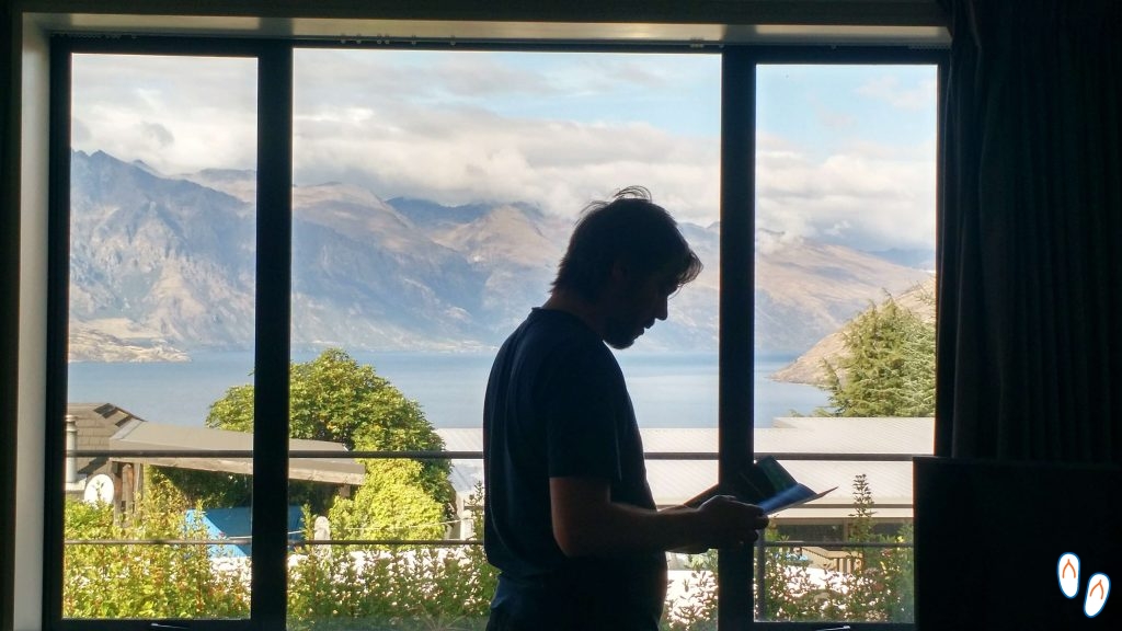 Our AirBnB in Queenstown with a view to the ‘Remarkables’
Queenstown is a really small city, the center is easily reached on foot. The center of Queenstown is in the lower part, very close to the lake. A good point of reference is Readings Cinema.
Fot those without a car, it’s worth trying to stay close to the center. Although prices are usually higher.
Since we had a car, we decided to stay in an AirBnb in Fernhill. This neighborhood is a little further from the center, but it took less than 10 minutes to reach by car. In the end, the location was excellent because it was in a higher spot and the view to the Remarkables was really memorable.
Getting around Queenstown
 Queenstown to Glenorchy road – one of New Zealand’s most scenic roads!
Public transport works very well in Queenstown. The regular fare is NZD 5.00, but you can pay only NZD 2.00 if you purchase the GoCard. The card can be purchased at Queenstown Airport or on the bus and costs NZD 5.00. Check out more information on the Otago Regional Council website.
If you stay in the center, you may not even need public transport. Queenstown is small and you can easily walk or cycle. The tours often include their own transport, it is worth checking each case.
The car is very worthwhile for those who want to explore the region in their own time. The topography of southern New Zealand provides wonderful scenery, with mountains and lakes everywhere. For those who like to drive, I recommend renting a car to visit neighboring cities like Arrowtown and Glenorchy.
What to do in Queenstown
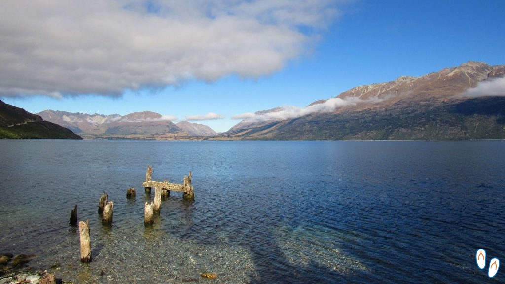 The giant Lake Wakatipu
Queenstown is New Zealand’s extreme sports capital. Adventure activities that can be done in Queenstown include bungee jumping, skydiving, paragliding, balloon rides, rafting, jetboat rides, offroad trails, cycling, among others. All you have to do is choose. I will describe in more details below the ones we did.
First of all, what I recommend is to plan right from the start what you intend to do. The Queenstown tourism website has a lot of information about the activities. Some activities have very limited places and without prior reservation you may simply not be able to do so.
In addition, the agencies that sell the tours are free to negotiate values. That said, if you hire a “package” with the same company you can get some discount.
It is worth researching and negotiating prices. Many agencies sell tours not only from Queenstown, but from other places as well. We negotiated a “combo” with 2 tours in Queenstown, and one in Australia, which would be our next destination. That way we got a reasonable discount.
Considering that the prices of this type of activity are very high, any discount is more than welcome.
Jetboat
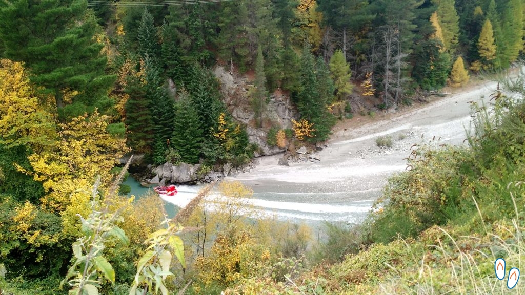 Jetboat “ripping” at Shotover Canyon
The jet boats were invented by the neo zealanders themselves, and today they are used as a tourist activity. Jetboat rides in Queenstown involve a few minutes of adrenaline on a jet boat that spins along narrow stretches of a canyon and spins 360 degrees.
You will notice that there are a few companies offering this type of activity, each one in a different location.
We chose to do it with the Shotover Jet, which runs through the Shotover Canyon, basically because it is the most traditional. The time in the boat is 25 minutes, and the regular price is NZD 149 per person (ouch!).
The ride was really fun. We left there soaked, but we had a lot of laughter. I recommend!
Swing
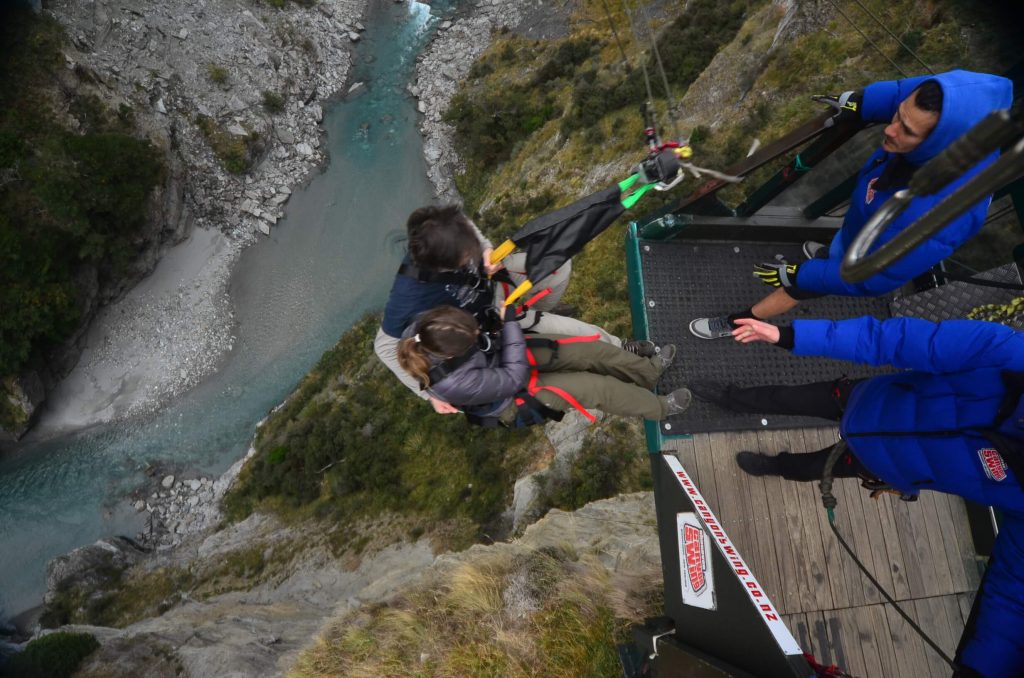 At the time of the “jump”
Swing is an activity very similar to bungee jumping. But the swing’s trajectory is like a pendulum, not vertical. So you get a free fall for a little while, but then you start to be pulled laterally by the rope until it stops completely. The good thing is that the transition is so subtle that you don’t even feel it.
I had never jumped anywhere and was terrified of it. I agreed to jump as long as I wasn’t alone and could go backwards. In fact, in swing you may jump any way you want. People who jump often usually seek to innovate by playing in different ways.
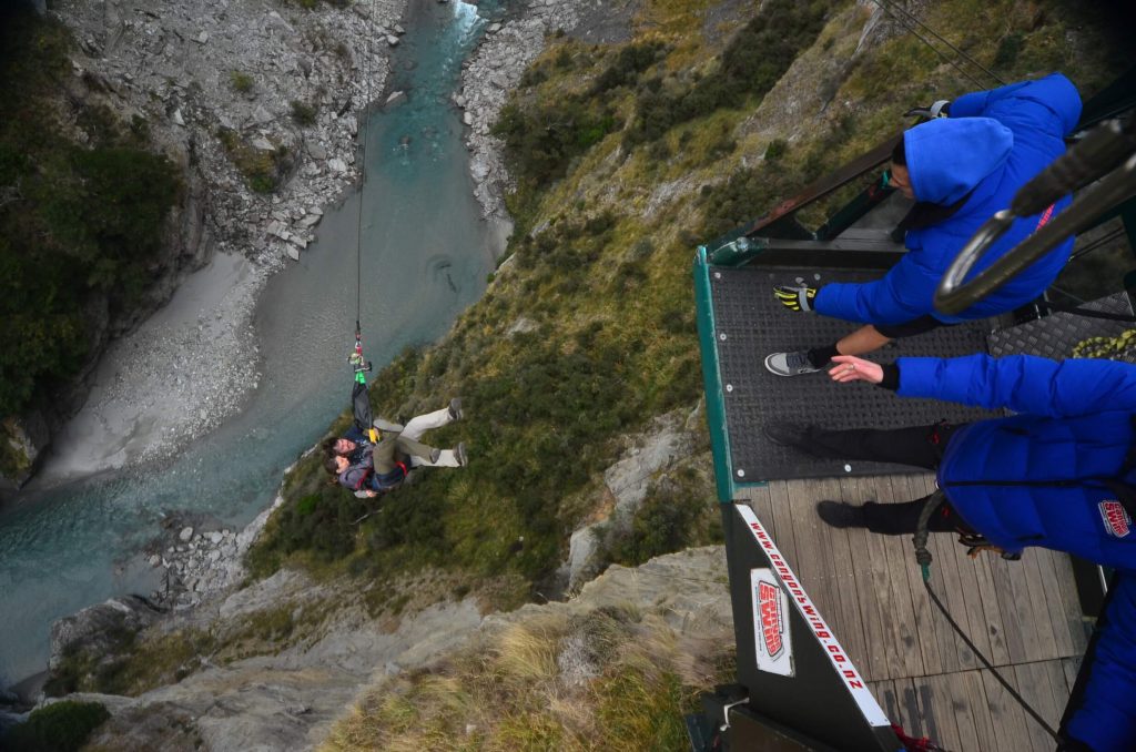 In free fall at Shotover Canyon, Queenstown
In Queenstown there are a total of 4 locations that perform bungee and swing activities. The tallest of all is the Nevis, with 160m of height. We did the Shotover Canyon Swing, held in the Shotover Canyon. The same company performs the Swing and also Shotover Canyon Fox, a zip line with free fall.
The Shotover Canyon Swing is 109m high and 60m of free fall. It’s a few seconds of adrenaline, but it was really worth it, and it makes you want to go again.
The regular price of this activity is NZD 249 per person – regardless of whether you are doing it alone or in pairs. Transport is included. Photos and videos are charged separately.
Skyline Queenstown
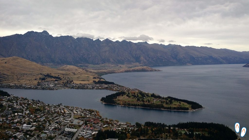 View from the Queenstown Skyline to the city with the “Remarkables” in the background. Now imagine that view with sun and blue sky.
Skyline Queenstown is a park built on top of the mountain called Bob’s Peak. The main attractions of this place are the gondola, the Luge Run and the incredible view of the city from above. The park also has a mountain bike trail.
We purchased the ‘Gondola + 2 Luge’ combo and its cost was NZD 55 per person. This combo allows the person to use the gondola to go up and down the mountain and do 2 Luge Run races. This is almost as if it were only 1, since the 1st race is mandatorily done on a training track.
The price the park’s access by gondola (without the luge) is NZD 35.00 per person. Tickets are sold on site. We bought it there and we had no problem.
What is Luge Run?
The ‘luge’ is a type of sled designed for winter sports. In New Zealand, cities like Queenstown and Rotorua offer luge run as an entertainment option. It’s not like a kart race; in ‘luge run’ the person starts the run alone, being able to overtake or be overtaken after a few meters.
The track is always on a slope and usually has several curves. At the Skyline Queenstown Luge Run, the track is 800m long. Each person controls their own speed. It’s fast, but a lot of fun.
I recommend going on a clear day so that you can better enjoy the view from the top of the mountain.
What else to do in Queenstown
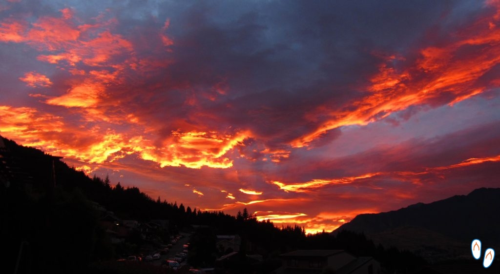 “Burning sky” in Queenstown – the incredible view of the dawn sky with the “perfect distribution” of the clouds.
Queenstown, although very touristic, is a very pleasant city, with a beautiful mountain landscape. I guess even those who do not enjoy adventure activities will enjoy staying there for a few days.
Queenstown has many shops, cafes and restaurants. The cinema is “boutique” style, small and super charming, with a vintage look.
Fergburguer is a very popular burguer place, it has the reputation of having the best burger in the world – we liked it, but we don’t think it’s the best we’ve ever eaten.
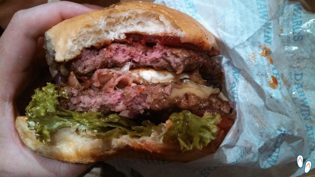 Fergburguer’s burger, in Queenstown..
For those who like cookies, I highly recommend visiting Cookie Time. The place has a childish appeal but the cookie is really tasty and always has some promotion or gift.
Queenstown also hosts a number of seasonal festivals. Click here to access the events calendar.
Queenstown’s surroundings also offer many possibilities. The region is a wine producer, and some wineries are open for visitation. Arrowtown and Glenorchy are also 2 nearby cities that are worth a visit.
Arrowtown
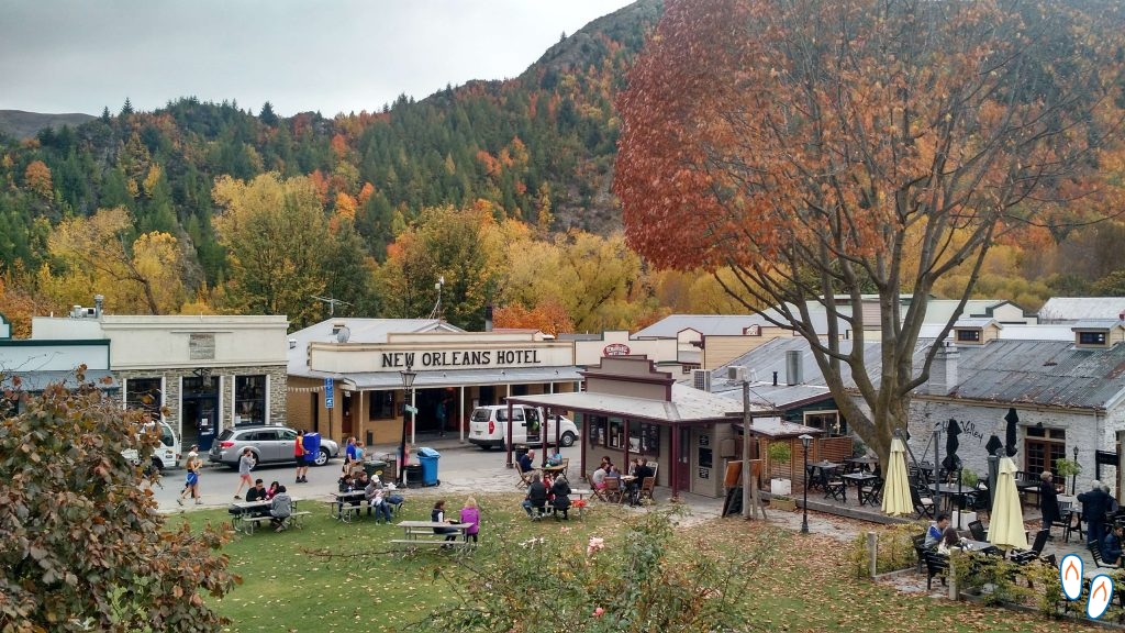 The friendly city of Arrowtown, at 20km from Queenstown.
Arrowtown is a city that looks like it came out of a wild west movie. This charming city is only 20km from Queenstown and is an excellent option for a day trip.
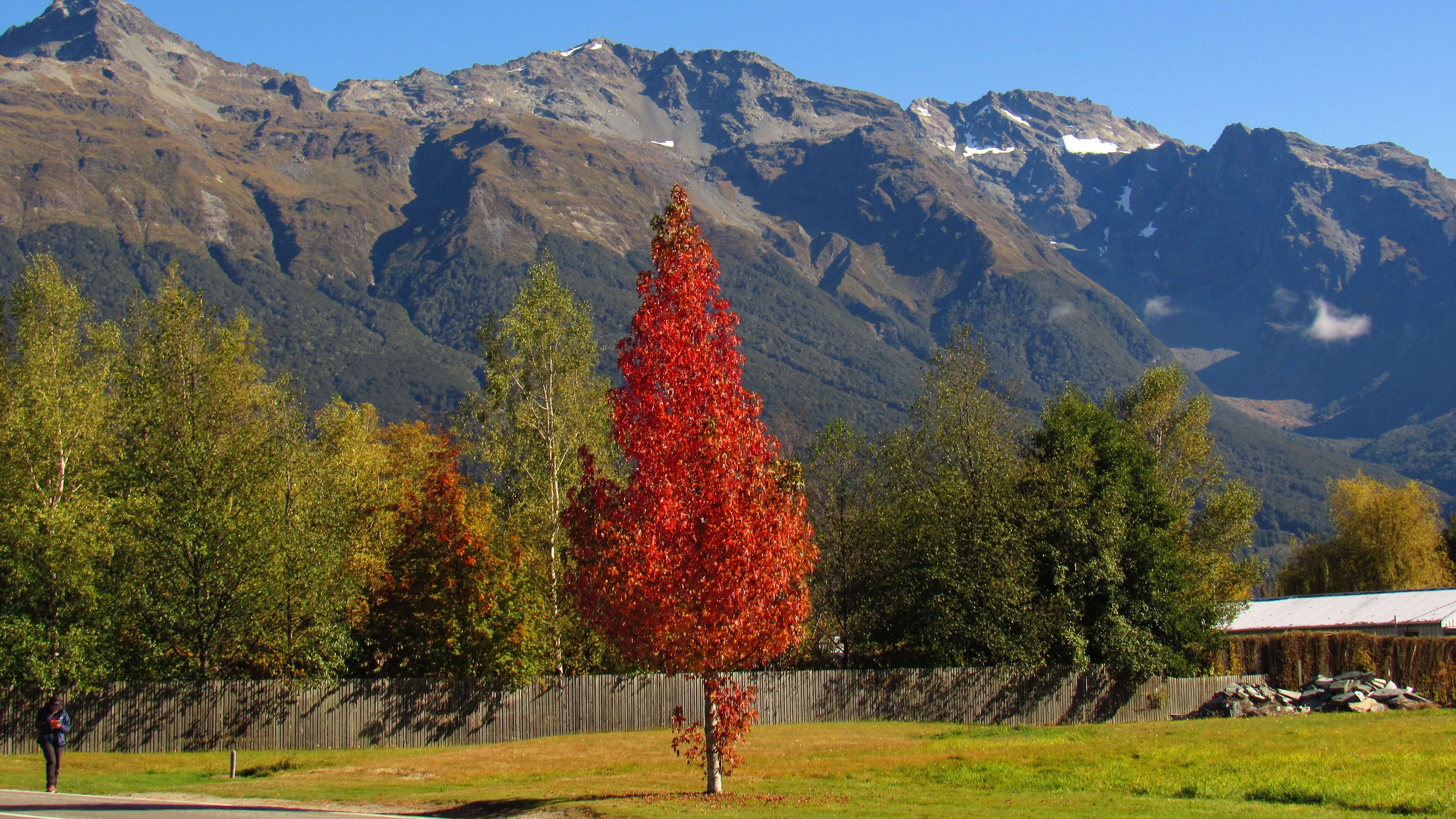
During fall, Arrowtown looks especially beautiful with the color change in the trees.
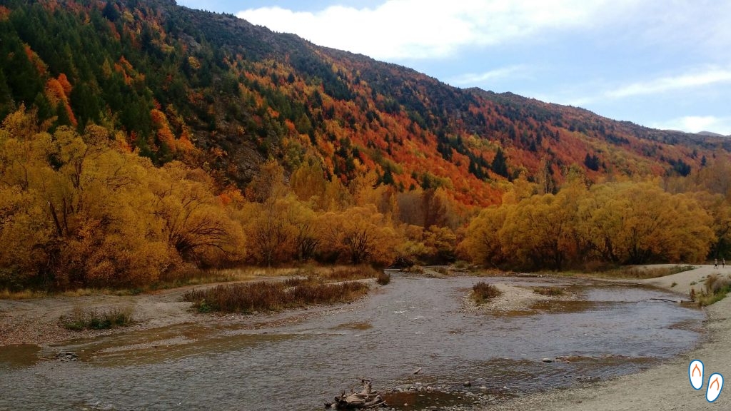 The colors of the Arrowton trees in the fall with the Arrow River – it’s worth a 1-day trip!
The city is of historical importance during the gold mining period. Mining was an important economic activity for the province of Otago in the 19th century. Currently, people practice “fake mining” on the River Arrow.
Curiosity: River Arrow was the location used by Peter Jackson to film the scene in which Arwen outwits the Nâzgul while taking Frodo to Rivendell, in the film Lord of the Rings: The Fellowship of the Ring.
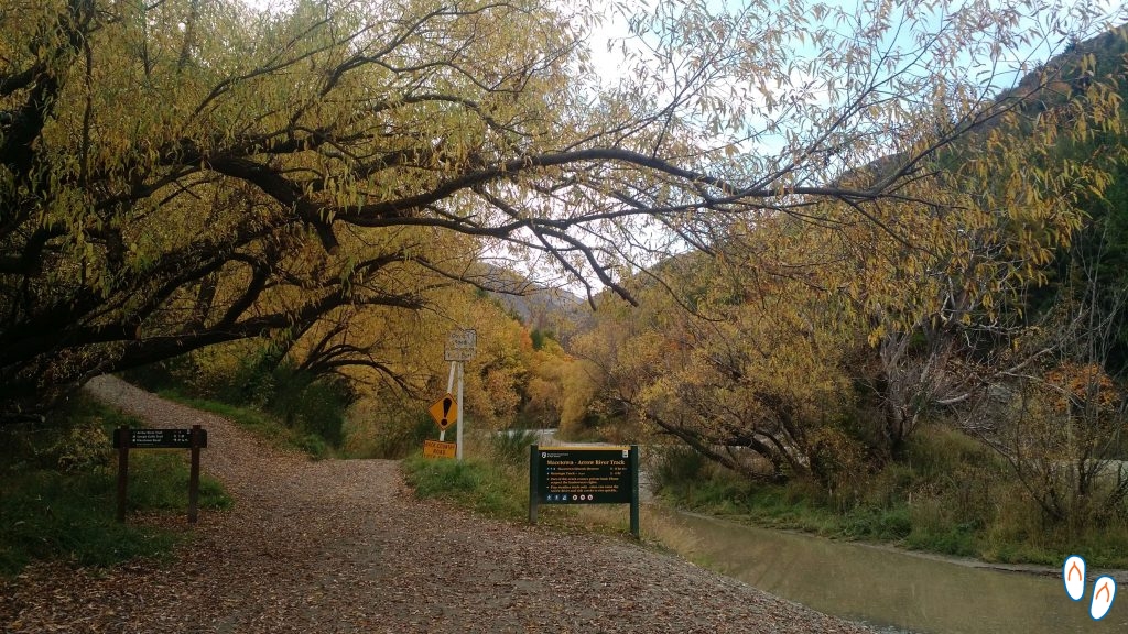 Start of the trail to Macetown, in Arrowton
Another city that was also important during the mining era is Macetown. Macetown is only 15km away from Arrowtown, but there are no roads connecting the 2 cities. Macetown is now an abandoned city and has become a historic reserve. People visit this ghost town on trails (on foot or by bike) or on 4x4 tours.
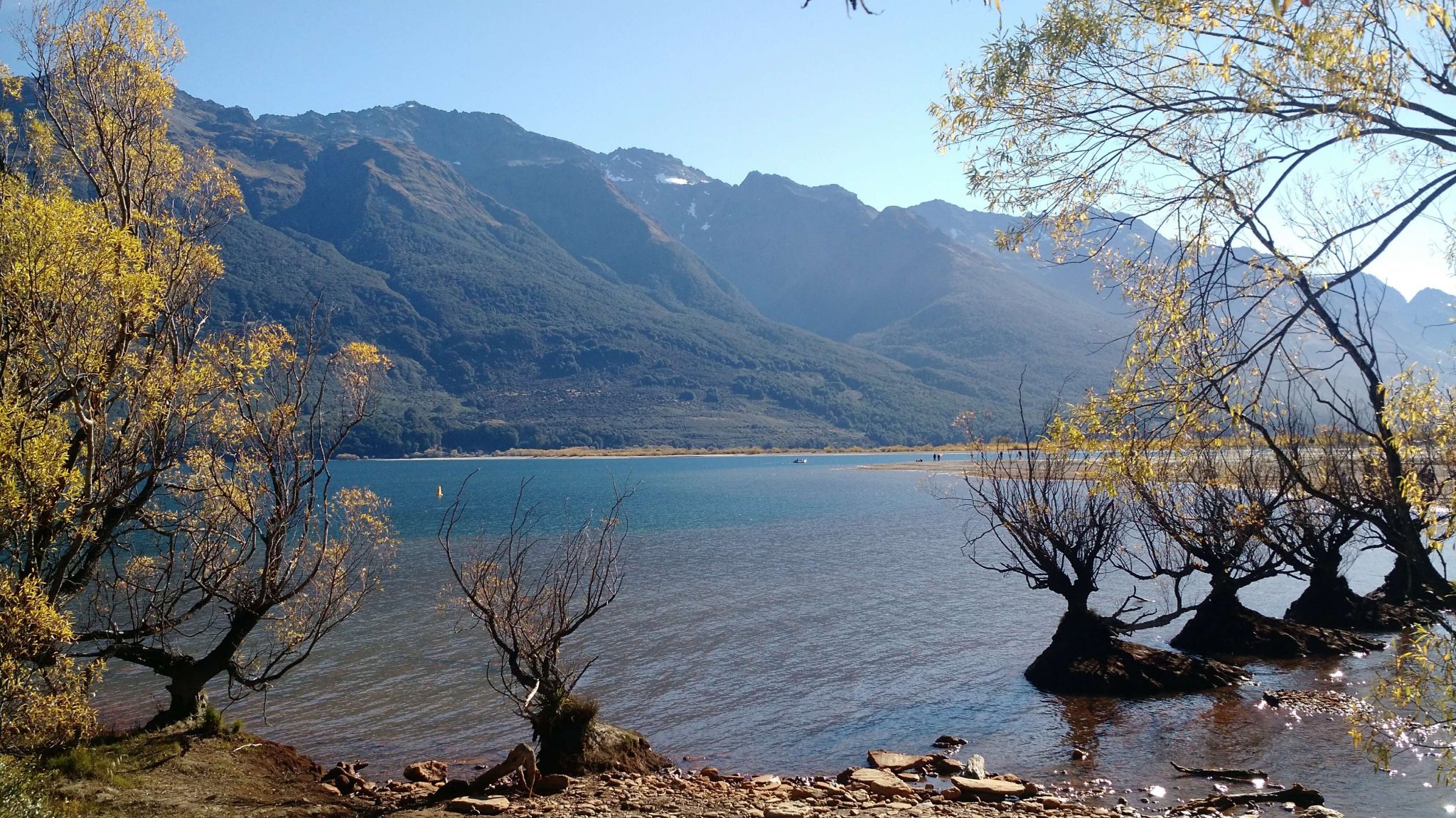
Glenorchy


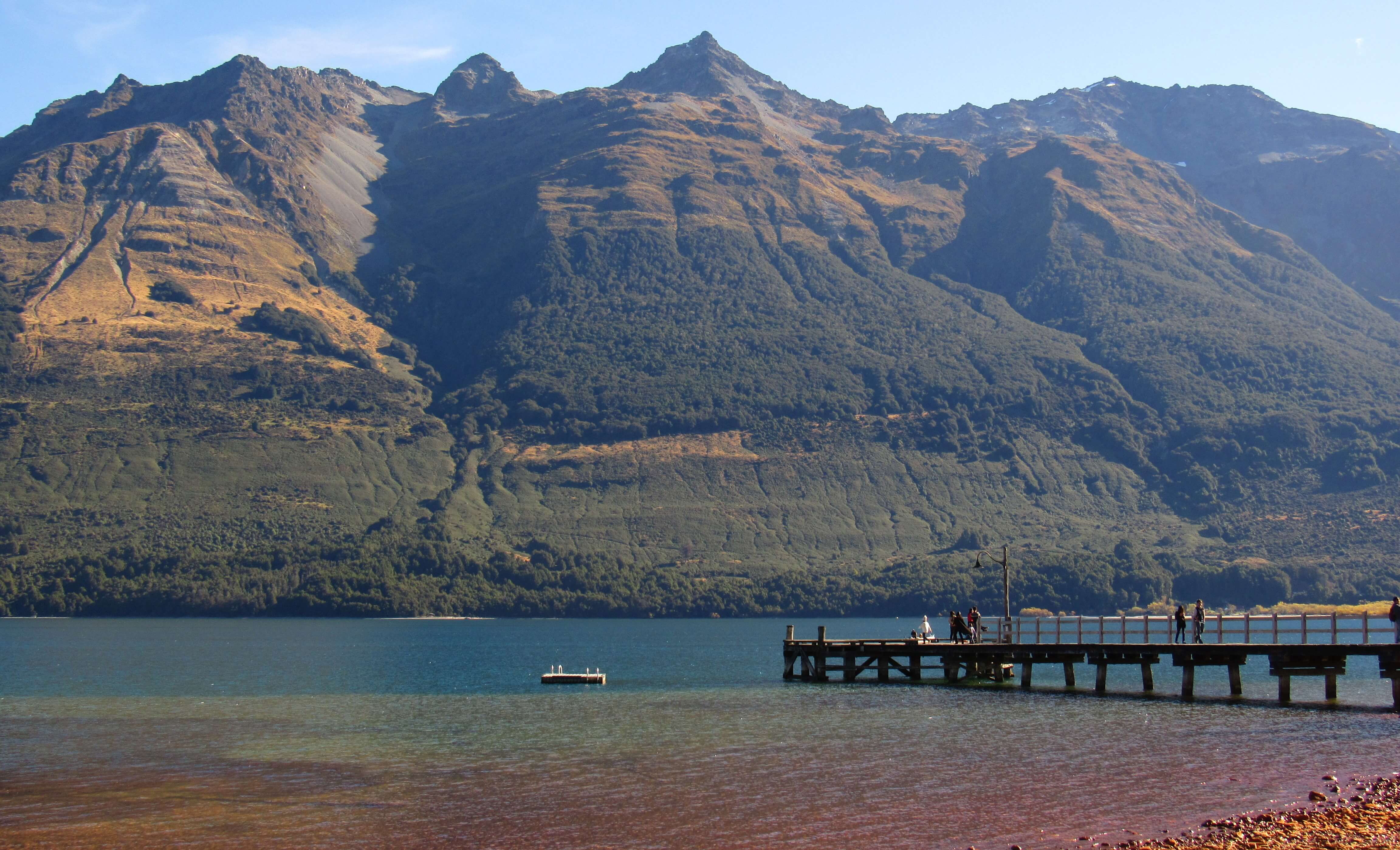
Photos of Glenorchy and the road – swipe sideways to see all.
Glenorchy is at the northern tip of Lake Wakatipu, about 45km from Queenstown, on the South Island of New Zealand. This small village is one of the gateways to Mount Aspiring National Park on the west coast of New Zealand.
Because of its location close to the mountains, Glenorchy is the starting point for some 3-5 day trails, famous for the beautiful landscapes of Mount Aspiring National Park, such as Routeburn Track. There are also jetboat and funyaks (inflatable kayaks) rides on the Dart River.
But even for those who don’t intend to do extra activities, Glenorchy is worth the visit. It is an excellent place to have lunch and spend the afternoon. In addition, the trip itself from Queenstown to Glenorchy is very scenic, with the view of Lake Wakatipu on the road and the mountains in the background.
If you have a 4x4 car, you may want to risk taking the road from Glenorchy to Paradise. The road arrives at the place that was used as ‘Isengard’ in the filming of The Lord of the Rings. It was a path we tried to take in a low car but ended up giving up due to the conditions of the road and flooded stretches.
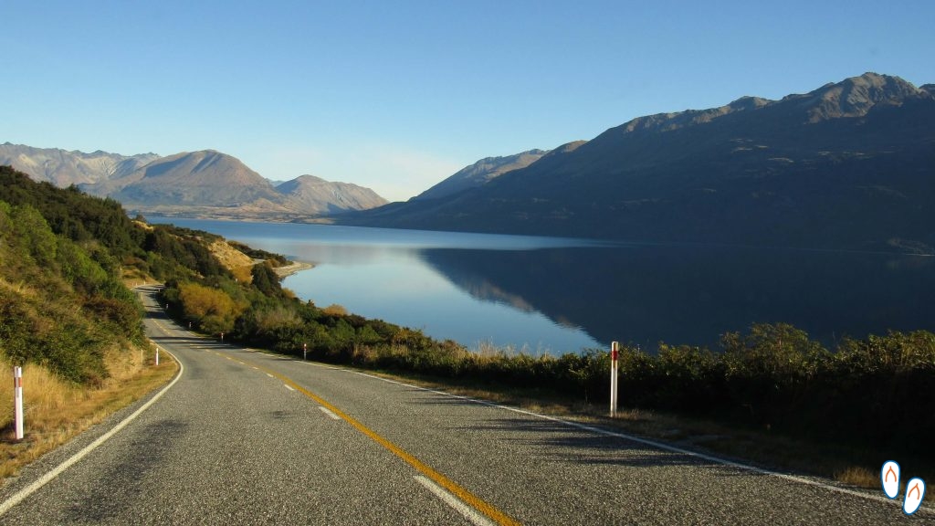
 Visual of Lake Wakatipu, on the road from Queenstown to Glenorchy.
Did you like this post? Share it with your friends:
You may also like:
New Zealand – a trip through this amazing country
North Island of New Zealand
PHOTO GALLERY
0 comentários